Category Archives: Travel

Querétaro Travel Guide

Mexico › Querétaro
Updated: March 2, 2022

See Also
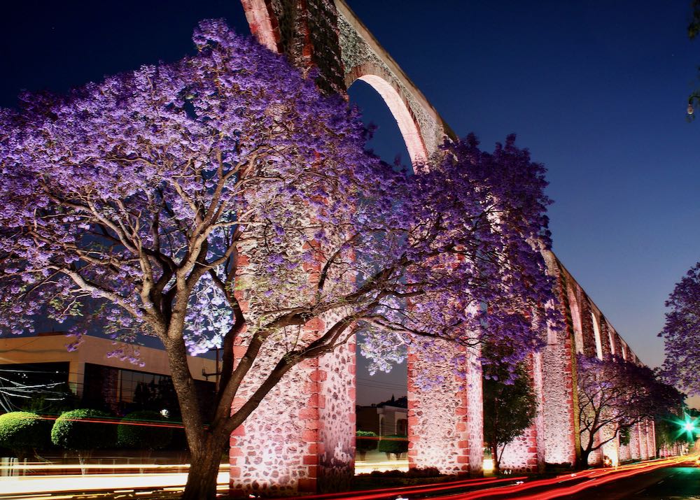
Rosewood tree in Querétaro Mexico

Of all Mexico’s colonial cities, Querétaro is one of our perennial favorites – loaded with historic gems, baroque churches, museums, shady plazas, and relaxed street cafés, but with a fraction of the tourists that visit the nation’s more famous destinations.

Frequently Asked Questions about Querétaro

Where is Querétaro?

Querétaro is the capital city of the Mexican state of Querétaro, located in the region of central Mexico known as the Bajío.

Querétaro lies about 215 km northwest of Mexico City, 65 km southeast of San Miguel de Allende, and 365 km east of Guadalajara. Non-stop flights to Querétaro take 1 hour from Mexico City, 1 hour 15 minutes from Monterrey, 2 hours 5 minutes from Houston, 2 hours 25 minutes from Dallas, and 2 hours 25 minutes from Cancún.

How big is Querétaro?

Querétaro has a greater metro population of just over 1 million – it’s one of the fastest growing (and richest) cities in Mexico. It covers an area of around 760 square kilometers, on the edge of the Sierra Madre Oriental.

What is the history of Querétaro?

Querétaro (“rocky place”) was once the home of the Otomi and Chichimeca peoples – at the time of the Spanish Conquest, it was part of the Aztec Empire. The Spanish settlement was officially founded in 1531 by Hernán Pérez Bocanegra y Córdoba and an Otomi leader known as Conín, but development was slow and it only became a town formally in 1606. Colonial Querétaro flourished thereafter, becoming one of the cradles of Mexican Independence.

It was here, meeting under the guise of Literary Associations, that the Independence conspirators made their earliest plans. In 1810 one of them, María Josefa Ortiz de Dominguez, wife of the town’s Corregidor (or governor – she is known as “La Corregidora”), found that her husband had learned of the movement’s intentions. Although locked in her room, La Corregidora managed to get a message out warning the revolutionaries, thus precipitating an unexpectedly early start to the struggle for independence.

Later, in 1867, the French-backed Emperor Maximilian was executed by a firing squad at Querétaro, and the city hosted an important assembly of Revolutionary politicians in 1916, leading eventually to the signing here of the 1917 Constitution, which is still in force today.

How do I get to Querétaro?

Querétaro is connected to the US by several non-stop flights, from Chicago, Dallas, Detroit, and Houston; domestic flights connect Querétaro with major destinations throughout Mexico. Flights from Canada or Europe will likely route through the USA or Mexico City.

Within Mexico, first-class long-distance buses are an economical and comfortable alternative to flying – buses to Querétaro from Guadalajara (4–5 hours), Mexico City (3–4 hours), and San Miguel de Allende (1 hour 15 minutes) operate every 30 minutes. Querétaro’s massive Central de Autobuses (bus station) lies 6km south of the city center. Arriving there it’s best to take a taxi to your hotel – these follow a fixed-rate system, with the current rates displayed at kiosks at the exit (pay here before getting in).

What are the options for Querétaro airport transportation?

Querétaro’s airport lies 32km northeast of the city center on the Hwy-200 towards Tequisquiapan. We recommend taking one of the airport taxis (around M$350) or an Uber to get to the hotel.

What about Uber in Querétaro?

Uber does operate in Querétaro (assuming phones have roaming, and the app works), and drivers will usually pick-up from the airport, though they do face the usual hostility from the airport taxi union. An Uber ride into the city should be cheaper – around 290 pesos – than regular taxis. Once in the city, getting an Uber should be no problem.

Can I drive to Querétaro?

Driving down to Querétaro from the US border is relatively straightforward – the main highways are good, and virtually empty outside the towns. However, the Mexican border states of Nuevo León and Tamaulipas have been affected by drug cartel violence – driving at night is definitely a bad idea. Check the latest travel advisories at travel.state.gov or ask the hotel. Cars also need a Mexican “Temporary Importation of Vehicle Permit”.

From Brownsville, Texas the drive is around 525 miles (845 km) and takes around 10 hours non-stop. Querétaro is 570 miles (917 km) from Laredo, Texas (11 hours), and 2590 km from Tijuana, on the southern border of California.
If renting a vehicle, it’s much easier to do this once across the Mexican border, as taking US rental vehicles into Mexico comes with all sorts of restrictions.

Do I need a car in Querétaro?

It’s easy to explore most of Querétaro’s city center on foot; otherwise call an Uber or take a local taxi (taxis have meters, initial fare 25 pesos). The city has an excellent public bus system (fares 11 pesos), but most tourists are unlikely to need it.

When is the best time to go to Querétaro?

Querétaro boasts a year-round temperate climate, with the driest and sunniest months October to April. Rain is most common July to August. There’s no real “bad” time to visit, though it can actually get chilly November to January. March through June is probably best, when the weather is pleasantly warm, the days generally dry, and crowds low-key.

Where should I stay in Querétaro?

The best place to stay in Querétaro is right in the historic heart (the centro histórico), close to all the sights, best restaurants, and attractions. Modern business hotels and cheaper motels line the highways on the outskirts of the city, but these are all a long way from the action and it can be hassle shuttling back and forwards. We like La Casa del Atrio, a posh B&B and spa with fabulous views and facilities, and the lavish Casa de la Marquesa (Madero 41), housed in a 1756 mansion with a gorgeous Mudéjar-style courtyard. Kuku Rukú and El Petate Hostel are our favorite budget options.

What are the best things to do in Querétaro?

Soak up the Querétaro’s colonial charm and be immersed in Mexico’s revolutionary history. Sip coffee at an outdoor café and take in the scene on Querétaro’s three main squares: the elegant Jardín Zenéa, Plaza de la Independencia, and Plaza de la Constitución. Learn about the Mexican War of Independence at the Museo de los Conspiradores (Andador 15 de Mayo no. 18), and the history of Querétaro state at the Museo Regional de Querétaro (Corregidora Sur 3). The story of the French Intervention and Emperor Maximilian is told at the Museo de la Restauración de la República (Guerrero 23), while the incredibly ornate Museo de Arte de Querétaro (Allende 14) is crammed with Mexican art from 17th-century to the present day.

Querétaro’s churches are similarly enticing, with our favorites the Templo de San Francisco on Jardín Zenéa, with a beautiful dome covered in azulejos (colored tiles); the Templo de Santa Clara (Madero 42), with its exuberant Baroque interior; and 18th-century Templo de Santa Rosa de Viterbo (Arteaga, at Montes), with another magnificent interior and a blue-and-white-tiled dome.

It’s also worth checking out the 19th-century Teatro de la República (Juárez at Ángela Peralta), where the Mexican Constitution was debated in 1917, and the quirky Museo Casa de la Zacatecana, an 18th-century mansion that preserves the grisly legend of its former owner (the evil Zacatecana murdered her husband).

For longer excursions, stroll out to Cerro de las Campañas, the “Hill of Bells” west of the center, or to the Convento de la Cruz (Ejército Republicano, at Felipe Luna), an old Spanish monastery that harbors the “Árbol de la Cruz”, a tree whose thorns sprout in the shape of little crosses.

What are the best things to do around Querétaro?

Querétaro makes a good base to explore the surrounding area, especially the hills of the Sierra Gorda. Some 60km east of Querétaro, the pretty village of Bernal is best known for the Peña de Bernal, a 350m-high peak of volcanic rock that towers over the area. Nearby Tequisquiapan is a gorgeous colonial Spanish town crammed with boutique hotels, spas, and craft markets.

What are the restaurants like in Querétaro?

Querétaro has excellent restaurants. The city is known for a couple of specialties; a thick lentil soup laced with chunks of dried fruit (“sopa regional”), and the local take on enchiladas (“enchiladas Queretanas”), fried with chili sauce, onions, and cheese. A good place to try them is Café del Fondo (Pino Suárez 9). Some of the best snack food in the city is knocked out at Tamales y Atoles Arteaga (Arteaga 48) a tamale specialist, while San Miguelito (Andador 5 de Mayo 39), is one of the city’s best Mexican restaurants. For something special try to snag a table at Chinicuil (Pasteur Sur 52), showcase for the contemporary creations of celebrity chef Alan Rodríguez. Since the COVID pandemic, the restaurant has been mobile (“nomada”), with pop-ups held throughout the city and announced on Instagram.

What currency is used in Querétaro?

The Mexican peso (often prefixed with a “$” sign) is the currency of Mexico and used in Querétaro. Most major shops and restaurants accept credit cards, but it is a good idea to have some peso cash on hand for museum entry and small purchases like bottled water and snacks. Banks and ATMs are easy to find in Querétaro, especially around Jardín Zenéa.

Is Querétaro expensive?

It’s easy to visit Querétaro on a modest budget. To save cash, stay in the cheaper B&Bs or hostels (budget Airbnb deals are also a viable option), and eat at local restaurants and taco stalls. Buses and taxis are cheap, and museum entry is rarely more than US$2–3.

Is Querétaro safe?

Querétaro has generally avoided the drug violence that has affected other parts of Mexico. Take the usual precautions, especially at night, and keep valuables in room safes.

Read More

Where to Stay in Palenque

Mexico › Best Places to Stay in Palenque
Updated: March 2, 2022

See Also

Palenque is a small city in southeastern Mexico, best known for its sensational Maya ruins, set on the edge of the rainforest, buzzing with colorful birds and the haunting cries of howler monkeys.

Frequently Asked Questions about Palenque

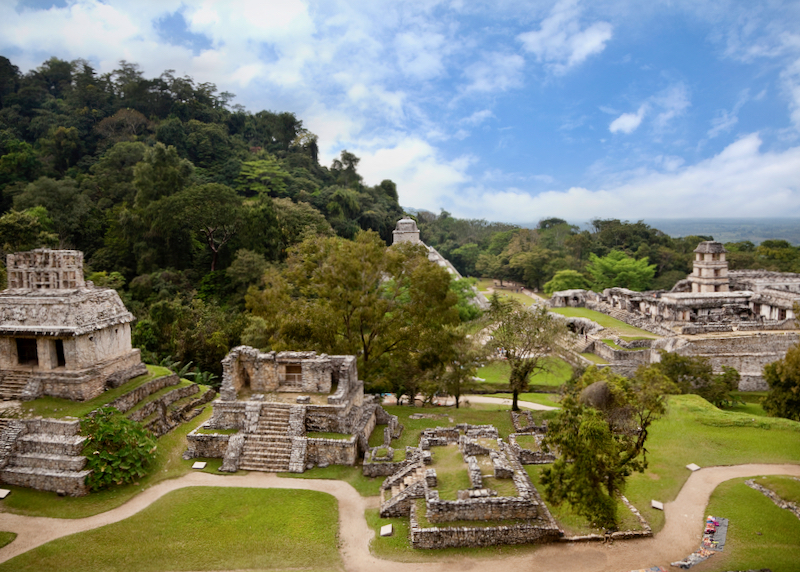
palenque mayan archaeological ruins

The ancient Mayan ruins complex of Palenque, a UNESCO World Heritage Site in the rain forest of Chiapas.

Where is Palenque?
Palenque is a small modern city and adjacent archeological site in the southeastern Mexico state of Chiapas. Palenque lies around 270 km northeast of the Chiapas state capital Tuxtla Gutiérrez, 210 km northeast of San Cristobal de las Casas, 900 km southeast of Mexico City, and 835 km southwest of Cancún. Non-stop flights to Palenque take 1 hour 30 minutes from Mexico City.

How big is Palenque?
Palenque has a population of around 42,000, including a large Ch’ol (Maya) indigenous community. The city proper covers a relatively small area and is surrounded by rainforest. The archeological site and ancient Maya ruins of Palenque lies some 8 km southwest of the modern city center.

What is the history of Palenque?
The modern city of Palenque was formally established by Spanish missionary Pedro Lorenzo in 1567, as part of an effort to convert the rural Maya population to Christianity. It remained relatively isolated in the rainforest and was only designated a town in 1813 (it became a city in 1972). The main roads were finally paved in 1990. The ancient Maya city of Palenque is much older, and was already abandoned when the Spanish arrived (the Spanish discovered the ruins in 1740). The earliest remains at Palenque date from around 300 BC, but the city was at its peak in the Maya Late Classic Period (c. 600–900 AD). Not much is known about the people that once lived here, though a list of kings, beginning with K’uk’ Bahlam I (431–435 AD), has been uncovered. The most famous king was Pakal the Great (615–683 AD), who initiated much of Palenque’s later construction. Palenque was abandoned by the Maya sometime in the 9th century, for reasons that are still unknown, though the most recent theories have focused on ecological factors, such as long-term drought.

How do I get to Palenque?
Palenque Airport (about 5 km northwest of the city center) serves just one route, the Interjet service from Mexico City – take a taxi into the center from here (250–300 pesos). Otherwise most travelers arrive by bus. Buses to Palenque from Campeche (5 hours 35 minutes); Cancún (around 13 hours); Mexico City (around 14 hours 30 minutes) and San Cristóbal (5 hours) arrive at the first-class bus terminal on the traffic circle in the center of the city, within walking distance of many hotels. Another option is to take a guided tour of Palenque from San Cristóbal de las Casas (via the waterfalls at Agua Azul), and ask to be dropped off in Palenque instead of returning to San Cristóbal. Hiring a taxi/driver is also possible but expensive; reckon on US$100–150 from San Cristóbal (5 hours) or a bit less from Villahermosa Airport in Tabasco (just 2 hours).

Is the overland route safe?
The main road to Palenque (north from San Cristóbal and south from the Yucatán) can be subject to closures by the local indigenous communities (during disputes with the government) and can result in lengthy delays – check the current situation at your hotel before buying tickets. Hold-ups of buses are very rare but can happen at night – robberies on buses at night have also been reported. Taking first-class ADO bus services during the day should ensure a safe trip.

What about Uber?
Uber does not yet operate in Palenque.

Can I drive to Palenque?
Yes, but it’s not recommended. It’s almost 1000 miles (1610 km) to Brownsville, Texas, and the roads in Chiapas can be rough (and unsafe at night). Drivers also need a Mexican “Temporary Importation of Vehicle Permit”.

Do I need a car in Palenque?
No. The center of the city is very small and easy to walk around on foot. The only journey requiring transport is the 8 km (or less, if staying in a hotel on route) ride to and from the Maya ruins; small minivans (colectivos) zip between the city center and ruins every few minutes (operated by Transportes Palenque). Just flag them down (around 35 pesos). Taxis are also plentiful in town and charge around 120 pesos for the ride to the ruins – fix the price before getting in.

When is the best time to go to Palenque?
November to February, when the weather is warm and relatively dry. Palenque has a tropical climate – it’s very hot March to May, and humid and rainy June to October, though the hotels will be a little cheaper at this time. Avoid Christmas and Easter, when domestic tourists pour into Palenque.

Where should I stay in Palenque?

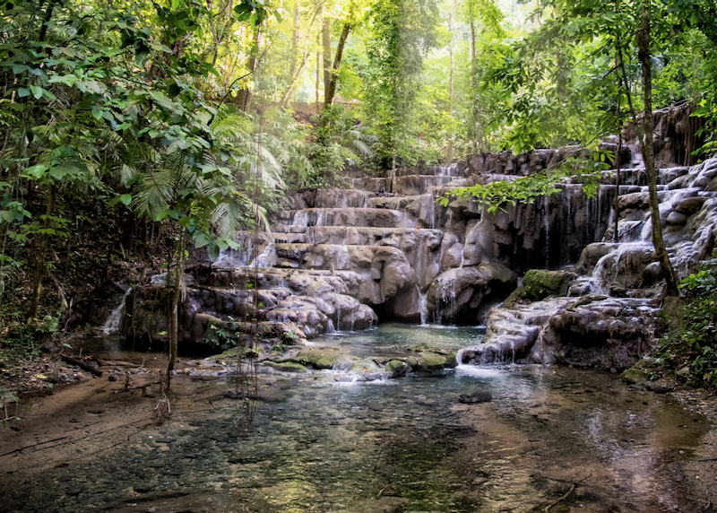
palenque queens bath waterfall

‘The Queen’s Bath’ waterfall in the forest within the Palenque Archaeological Zone.

There are three main choices in terms of area: the busy city center near the main plaza; the more residential and quieter neighborhood of La Cañada, just north of the bus station; and along the jungle-lined road to the ruins.

The city center offers the cheapest rates and proximity to services (banks, tour companies, laundries, restaurants and so on). We like the modern Hotel Maya Rue, on Aldama, between Juárez and 5 de Mayo, two blocks from the main plaza, and the newer Casa 5 B&B at Emilio Rabasa 45.

La Cañada is a bit more upmarket, and is a lot more tranquil – this is a good compromise as it’s still within walking distances of most services and restaurants. Recommended options here include Maya Tulipanes at Cañada 6, which has a pool, and friendly Hotel Museo Xibalba at Merle Green 9, which has a roof terrace.

The hotels on the road to the ruins tend to be better quality and more expensive – obviously more convenient for the ruins (there’s not much to see in town anyway), but less choices when it comes to eating and services, without zipping back and forth into town. Top of the pile is the luxurious Quinta Chanabnal (2 km from the city center), while the more affordable but recommended Chan-Kah Resort Village (3 km from the center) has the most attractive pool in Palenque.

What are the best things to do in Palenque?
There’s only one reason to come here – the ancient Maya ruins of Palenque (officially “Zona Arqueológica Palenque”), some of the most atmospheric in Mexico (there’s nothing to see in the modern city of Palenque). Though the ruins here resemble the Maya sites in Guatemala, Palenque developed its own distinctive architectural style. Highlights include the huge “Templo de las Inscripciones” step-pyramid (which still contains the original sarcophagus of Pakal the Great), and the unique square tower and beautiful relief carvings of “El Palacio”. The site’s location is also fabulous, surrounded by jungle-smothered hills, with stunning views of the pancake-flat Yucatán peninsular visible from the pyramids.

Palenque’s excellent museum, 1.5 km before the main entrance to the ruins, offers the best introduction to the site and displays many of the most important artifacts found here, including a replica of Pakal the Great’s engraved sarcophagus lid. The ruins are open daily and cost 80 pesos.

What are the best things to do around Palenque?

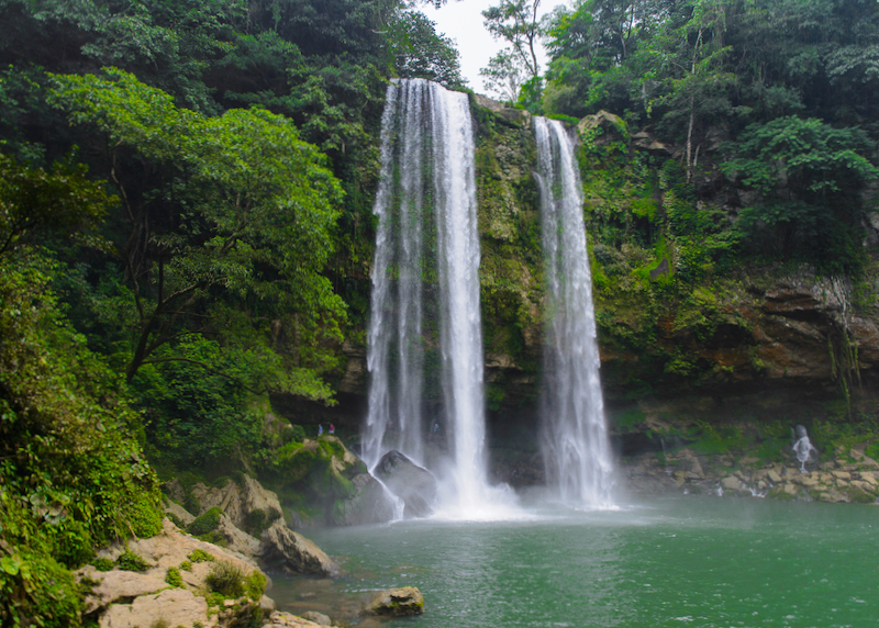
palenque misol ha jungle waterfall

The amazing Misol-Há waterfall. There is a pathway to walk behind the cascade, and you are able to swim in the pool below.

Numerous tour companies offer similarly priced trips to attractions around Palenque, notably the waterfalls at Agua Azul and Misol-Há. These are both beautiful and worth seeing – Agua Azul is the bigger and more developed site (and can be mobbed during holidays), while you can swim safely in the pool of water at the bottom of the falls at Misol-Há. Much longer day-trips take in the Maya ruins of Bonampak and Yaxchilán – both spectacular sites and well worth the time and expense (it’s much easier to visit these sites on a guided tour than solo). Recommended local operators include Na Chan Kan and Turistica Chambajlum.

What are the restaurants like?
Nothing special, but there are plenty of cheap places serving typical Mexican food and international favorites such as pasta and pizza in the city center, and better restaurants attached to the bigger hotels. Some of our favorites include Café de Yara in the city center (Hidalgo 66), which serves excellent coffee and breakfasts, then morphs into a fun bar at night. For no-frills but cheap and tasty Mexican food, try Taquería Tropitacos at Central Poniente 49, a block west of the main plaza. In La Cañada our go-to for Mexican staples is Maya Cañada Felíz (Merle Green 10), while Don Mucho (Carretera Ruinas-Palenque km 4.5) on the road to the ruins has relaxed outdoor seating, a decent international menu, and nightly live music.

What currency is used in Palenque?
The Mexican peso (often pre-fixed with a “$” sign) is the currency of Mexico and used in Palenque – businesses will generally not accept US dollars. Bring lots of pesos to Palenque – some shops and restaurants accept credit cards, but many don’t, and for bus trips and small purchases like bottled water and snacks, cash is king.

Where to change money in Palenque?
Using local ATMs will generally be cheaper than changing money at hotels or at casa de cambios (which will take a commission). Several banks along Juárez in the city center have ATMs – these will usually have cash Monday to Friday during bank opening hours, but can run out at night or at the weekends. There’s also an ATM at the bus terminal, but we don’t recommend using this (or any other ATM not attached to a bank branch), as these can get hacked by credit card scammers.

Is Palenque expensive?
No – hotels are good value and unless it’s a public holiday in Mexico, competitively priced. Budget airbnb deals are also a viable option. The local restaurants and buses/taxis are cheap, and the ruins are less than US$4 to enter.

Is Palenque safe?
Yes. Palenque itself has generally avoided the drug violence that has affected other parts of Mexico. Take the usual precautions, especially at night, and keep your valuables in room safes.

Read More

Monterrey Travel Guide

Mexico › Monterrey

See Also

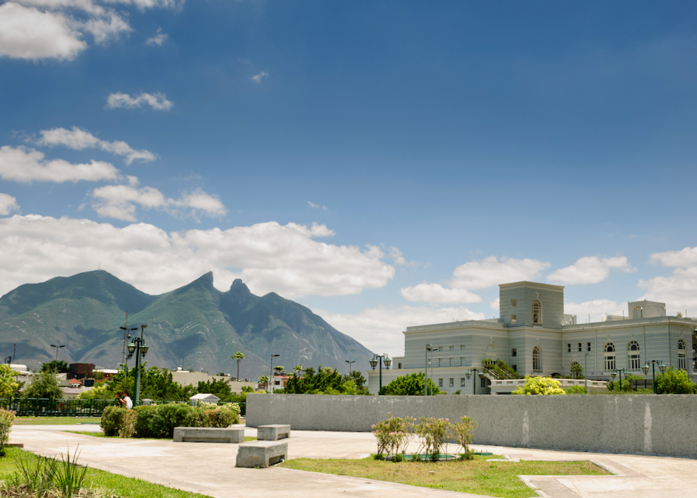
Mountains over downtown Monterrey.

The third-largest city in Mexico rarely attracts overseas tourists but it’s one of our favorite big cities, with some excellent contemporary museums and tons of character. This is the modern, dynamic face of Mexico, where colonial churches and cantinas stand side-by-side with the tallest skyscrapers in the country.

Frequently Asked Questions about Monterrey

Where is Monterrey?

Monterrey is the capital of the northeastern Mexican state of Nuevo León, in the foothills of the Sierra Madre Oriental. Monterrey lies some 222 km (138 miles) west of the US border at Reynosa/McAllen (Texas), 225 km (140 miles) south of the US border at Laredo, Texas, and about 910 km north of Mexico City.

Non-stop flights to Monterrey take 1hr 30 minutes from Dallas, 1hr 30 minutes from Guadalajara, 1hr 35 minutes from Mexico City, 1hr 35 minutes from Houston, 2 hours 40 minutes from Tijuana, and 2 hours 45 minutes from Atlanta.

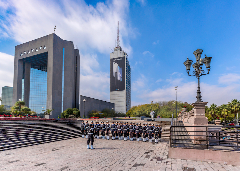
gran plaza police

Police assembled in the Gran Plaza, the 7th largest plaza in the world.

How big is Monterrey?

Monterrey has a greater metro population of over 4.5 million. The city proper covers an area of 325 square kilometers (125 square miles).

What is the history of Monterrey?

With the help of a small group of colonists, Spanish conquistador Diego de Montemayor founded Monterrey in 1596 – he also served as governor of Nuevo León during its early years. Yet the settlement remained small and insignificant well into the 19th century. Iconic Mexican brewery Cervecería Cuauthemoc was founded in 1890, and steel production began in 1900, fueling an economic boom that continues today – the city boasts Mexico’s two tallest buildings, the T.Op Torre 1 (Torres Obispado) and Torre KOI in the burgeoning business district of San Pedro Garza Garcia.

How do I get to Monterrey?

Monterrey is connected to the US by numerous non-stop flights, with flights from Dallas taking just 1hr 30 minutes. Monterrey Airport is also a major domestic hub, with services to almost every major city in Mexico. Flights from Canada, Europe, and the rest of the world generally route through Mexico City or airports in the US.

Within Mexico, first-class long-distance buses are an economical and comfortable alternative to flying – buses from Monterrey to Mexico City (11–12 hours), San Luis Potosí (7hr) and Zacatecas (7hr–7hr 30min) operate hourly. Buses also shuttle back and forth to the US border at Nuevo Laredo (3hr) and Reynosa (3hr).

Monterrey’s enormous Central de Autobuses (bus station) at Avenida Cristóbal Colón 855 lies 3km northwest of the central Macroplaza. Cuauhtémoc metro station is just next door, but when carrying a lot of luggage take a taxi (insist on the meter being turned on).

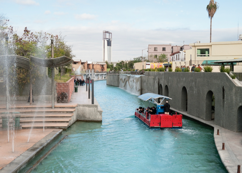
riverwalk tour boat

Boat tour along The Santa Lucia riverwalk, an artificial river that runs through the center of the city.

What are the options for Monterrey airport transportation?

Monterrey’s airport lies 6km or so northeast of the city center. We recommend getting a taxi into the city to save time – taxi fares are set according to a zone system, with the center around M$330 and San Pedro Garza García M$380 (buy a ticket at the terminal before exiting). Cheaper buses do shuttle between the airport and the Central de Autobuses (see above), every hour (and take around 45 minutes) for around 100 pesos, but you’ll still have to get to your hotel from there.

What about Uber in Monterrey?

Uber does operate in Monterrey (assuming phones have roaming, and the app works), but drivers are usually reluctant to pick-up from the airport due to hostility from the airport taxi union. However, an Uber can be taken back to the airport for as low as 240 pesos. Once in the city, getting an Uber should be no problem, and can be cheaper than regular taxis.

Various other ride-sharing apps operate in Monterrey, with Chinese-owned DiDi offering slightly cheaper rates, and Estonia-based Bolt another alternative, but we’d recommend sticking with Uber for first-time visitors.

Can I drive to Monterrey?

Driving down to Monterrey from the US border is relatively straightforward, and the highways are pretty good (and fast). However, the state of Nuevo León has a reputation for violent crime and drug gang activity – definitely avoid driving at night. The drive from the Texas border at Laredo takes just under 3 hours (it’s about the same from the border at McAllen/Reynosa). Note that foreign vehicles need a Mexican “Temporary Importation of Vehicle Permit”.

If renting a vehicle, it’s much easier to do this once across the Mexican border, as taking US rental vehicles into Mexico comes with all sorts of restrictions.

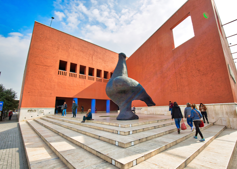
museum of contemporary art

Entrance to MARCO, The Museum of Contemporary Art.

Do I need a car in Monterrey?

It’s relatively easy and cheap to get around Monterrey on foot, by light rail, or taxi. Driving in the city can be a challenge (it’s often very congested, signage is poor, and road layout is confusing). It can be useful to have a vehicle to explore the surrounding area, though the bigger sights are all well-served by public bus or guided tours.

How do I get around Monterrey without a vehicle?

It’s easy to explore most of Monterrey’s city center on foot, or call an Uber or take a local taxi. If hailing taxes, be sure to use meters, which start at 8.80 pesos (10.55 pesos 10 pm–4 am) – trips anywhere in the center will rarely be more than 50 pesos.

Though the routes are somewhat limited for tourists, the speediest way to get around the city is to take the clean and efficient Metrorrey light rail system. It’s simple to use and rides cost just 4.50 pesos per journey.

When is the best time to go to Monterrey?

Spring and Fall are the best times to go to Monterrey. Monterrey tends to have hot, humid summers (with September the wettest month), which can make sightseeing extremely uncomfortable – from mid-February to mid-May, and October to November, it is warm, dry, and sunny. Winters can be a little cooler (day-time temperatures rarely fall below 70°F), but also very dry.

What are the main districts/neighborhoods of Monterrey?

The traditional heart of Monterrey is the Macroplaza (officially Plaza Zaragoza, or just the “Gran Plaza”), ringed by government buildings and museums. To the east lies the Barrio Antiguo, the city’s Old Town, while to the west (“Zona Rosa”) and north (just “Centro”) is the modern commercial and business districts. Beyond the city proper lie two sprawling suburbs that have become major business and residential districts in their own right in recent years: posh, skyscraper-heavy San Pedro Garza García to the southwest, and industrial San Nicolás de los Garza to the north.

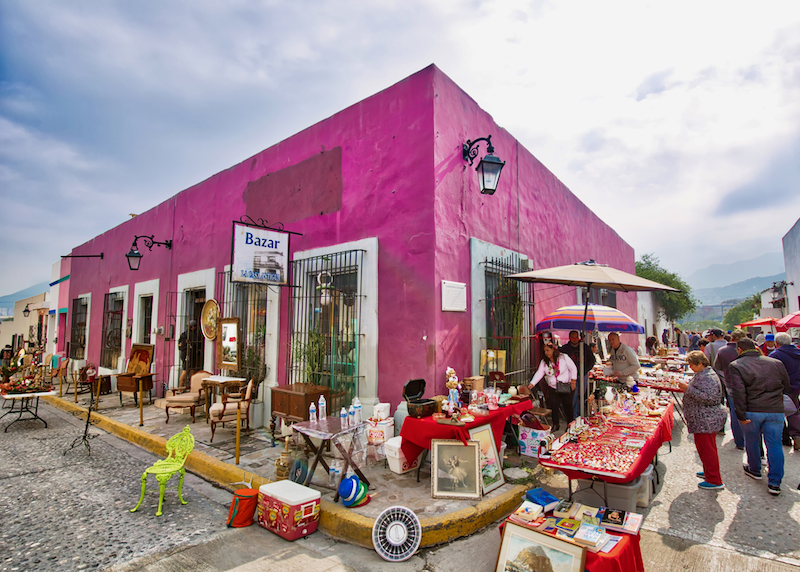
sidewalk market

A weekend market in the old city, Barrio Antiguo neighborhood.

Where should I stay in Monterrey?

First-time visitors to Monterrey should aim to stay near the Macroplaza, in the heart of the city – almost everything will be within walking distance or short taxi rides. Newer hotels and chain motels lie on the outskirts or in the “Valle” area near San Pedro Garza García, but these primarily target business travelers or those with cars – they are a long way from the main tourist sights. We like the Gamma Monterrey Gran Hotel Ancira, an Art Nouveau beauty opened in 1912. The iStay Hotel Monterrey Histórico is a cheaper, contemporary alternative.

What are the best things to do in Monterrey?

Monterrey is best known for its excellent museums. The Macroplaza itself is a Modernist, mostly green space enlivened by squawking red-crowned Amazon parrots and the city’s 18th-century cathedral. The plaza is also the seventh largest plaza in the world. The main draw here is the Museo de Arte Contemporáneo (MARCO), an innovative showcase for changing exhibitions of mostly Latin American (particularly Mexican) artists. It’s worth strolling the narrow streets of Barrio Antiguo just to the east, dotted with colorful adobe houses dating from the 1890s, independent galleries, and the city’s best bars and clubs.

At the northern end of the Macroplaza, the elegant former state government building is now the Museo del Palacio, a high-tech museum charting the Nuevo León’s transition from colony to federal state. The equally innovative Museo de Historia Mexicana chronicles Mexican national history, while the Museo del Noreste focuses on the history of northeast Mexico (including the US state of Texas). From the museums, take a tranquil boat ride along the Paseo Santa Lucía to the green swathe of Parque Fundidora, where a former steel-processing plant has been converted into another fascinating museum the Museo del Acero. The other must-sees in Monterrey include El Obispado, the bishop’s palace on top of a hill to the west of downtown, the glass exhibits at the Museo del Vidrio, and venerable Cervecería Cuauhtémoc Moctezuma, where tours of the brewery and plenty of fresh beers are offered.

What are the best things to do around Monterrey?

Monterrey makes a good base to explore the surrounding area. It’s a relatively easy outing to the impressive caverns of Parque Grutas de García, and the pretty historic village of Santiago, some 35km south of Monterrey. The nearby city of Saltillo makes for a fuller day-trip, packed with colonial architecture, museums, and shops selling traditional sarapes (multicolored woolen shawls). Buses shuttle between Saltillo and Monterey hourly (1 hour 30 minutes).

What are the restaurants like in Monterrey?

Restaurants in Monterrey are pretty good, with the usual range of Mexican options as well as international chains, though the focus is traditionally on meat-eaters, with regional specialties such as cabrito al pastor or cabrito asado (whole roast kid goat). The best place to try these is El Rey del Cabrito (Constitución Ote 817), while the excellent La Divina (Montemayor Sur 507) serves quality Mexican dishes conveniently close to the museums. For a treat, get a taxi to Pangea (Roble 660), showcase for the gourmet cuisine of local celebrity chef Guillermo González Beristáin.

government palace

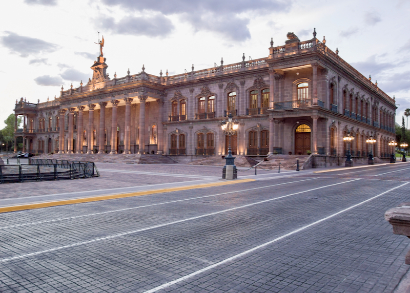
The historic Government Palace building in downtown.

What currency is used in Monterrey?

The Mexican peso (often prefixed with a “$” sign) is the currency of Mexico – US dollars and other foreign currencies will not be accepted in Monterrey. Most major shops and restaurants in Monterrey accept credit cards, but it is a good idea to have some peso cash on hand for bus trips and small purchases like bottled water and snacks. ATMs are easy to find in the center (especially on Padre Mier).

Is Monterrey expensive?

Monterrey certainly contains luxury hotels, designer shops, and pricey bars and restaurants, but it’s easy to visit the city on a modest budget. Most hotels are reasonably priced, budget Airbnb deals are also a viable option, museum entry fees are low (US$2–3) and public transport is cheap.

Is Monterrey safe?

Monterrey is safe for tourists. Monterrey is a big city, and does suffer from crime – take the usual precautions, especially at night (get hotels and restaurants to order taxis), and keep valuables in room safes.
Mexico’s drug wars have also taken their toll on the city and the surrounding areas, but despite the headlines drug gangs rarely, if ever, target tourists and the main, well-policed tourist areas of Monterrey are usually safe and violence-free.

Mérida Travel Guide

Mexico › Mérida
Updated: March 1, 2022

See Also

folkloric dancers

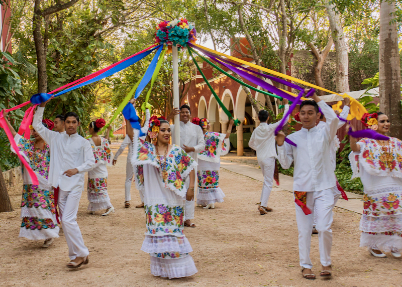
Folk dancers performing the maypole dance during a festival.

Frequently Asked Questions about Mérida

Where is Mérida?

Mérida is the capital of the state of Yucatan and it’s located in the South East of Mexico. It’s 8 meters above sea level and, together with the municipalities of Conkal, Kanasín, Ucú, and Umán, it forms the so-called metropolitan area.

How big is Mérida?

The municipality of Mérida covers an area of almost 535 miles (860 square kilometers). As is the case for practically the entire state of Yucatan, the territory is virtually flat, with only a slight slope towards the Gulf of Mexico. There are almost a million people living in Mérida’s metropolitan area.

What is the history of Mérida?

The city was founded in 1542 on the remains of T’Hó, a Mayan city that was practically uninhabited by that time. Some of the Spanish conquerors came from the region of Extremadura and decided to name it Mérida in honor of a city back home. The main reason for this was that the Mayan ruins reminded them of the Roman ruins found in the European Mérida.

How do I get to Mérida?

The Manuel Crescencio Rejón International Airport is located about 4 miles (7 kilometers) from the city, and it connects Mérida with 14 domestic and four international destinations. In addition, it’s possible to arrive by bus from Cancun. The journey lasts around four hours.

parade in front of municipal palace

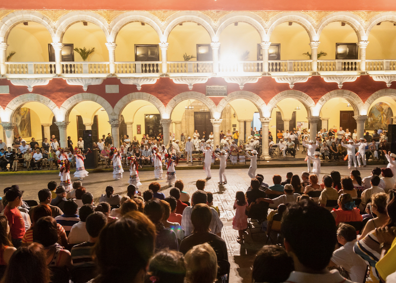
A nighttime parade in front of the municipal palace during a festival.

When is the best time to go to Mérida?

The best months to travel to Mérida, and in general to the entire Yucatan Peninsula, are December, January, and February. The temperature is slightly lower than the rest of the year, averaging 79ºF (26ºC). During this time, rain is scarce so you can walk around the city with ease.

What neighborhoods should I visit in Mérida?

Known as “the white city” (“La Blanca Mérida”) given the predominantly white buildings erect at its founding, Mérida’s architecture reflects several different periods of its history. The historic center is a perfect example of beautiful colonial architecture, while the iconic Paseo de Montejo is lined with mansions —some of them derelict, others turned into banks, restaurants, and boutique hotels— from its wealthy henequen industry days. Mérida’s most traditional neighborhoods are definitely worth a visit. El barrio de Santiago has a park that comes alive every afternoon, el barrio de Santa Ana is known for its markets and culinary exhibitions, and el barrio de Mejorada houses several museums.

Where should I stay in Mérida?

Deciding where to stay in Mérida is quite simple since there are accommodation options for all budgets. Undoubtedly, the two best areas for visitors are the historic center, with its colonial design and old town, and the area surrounding Paseo de Montejo, an avenue inspired by French boulevards where beautiful buildings, cafes, restaurants, boutiques, and bars abound.

horse carriage

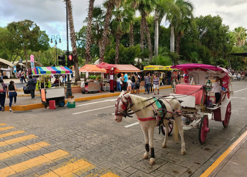
Horsedrawn carriage and street vendors on the main plaza downtown.

How do I get around in Mérida?

Mérida is a very well organized city. The streets are numbered with pairs going from north to south and odd numbers from east to west. To visit the center, a good option is to walk or rent a bicycle. Public transport is safe and connects practically the entire city. Digital apps such as DiDi and Cabify also operate in the city.

What are the best things to do in Mérida?

In the city, walking along Paseo de Montejo and admiring its beautiful buildings is practically mandatory, as is a visit to the Cathedral of San Ildefonso, the oldest in the country. Hopping on a Turibus to tour the city is a great way to see the main attractions. Mérida’s food scene is definitely something to write home about and visitors can’t leave without trying the marquesitas, a kind of ice cream cone filled with cheese. In the surrounding areas, it’s worth visiting Celestún and its flamingos, Izamal and its Mayan ruins, and the imposing Chichen Itzá.

How many days should I spend in Mérida?

Mérida is not a very big city, so it takes two or three days to visit its main attractions. However, it’s in a part of the country where visitors can admire gems like Chichen Itzá, one of the seven wonders of the modern world, and a myriad of sinkholes (cenotes). For this reason, those wanting to use it as a base to visit the surrounding areas would do well to stay up to a week.

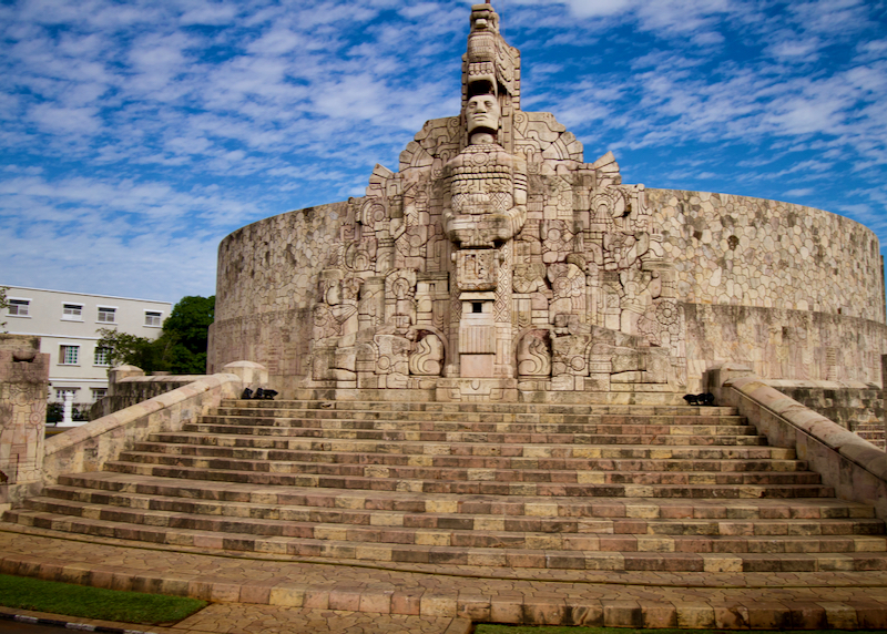
homeland monument

The Homeland Monument.

What currency is used in Mérida?

In Merida, as in the rest of Mexico, the currency is the Mexican peso. In 2020 the average exchange rate has been $20.20 pesos per US dollar. There are foreign currency exchange agencies in the airport but the best rate is always offered by the bank, so it’s advisable to pay with a credit card whenever possible and withdraw cash from an ATM.

Should I tip in Mérida?

Tipping is part of the hospitality culture throughout Mexico. In bars and restaurants, it’s common to leave between 10% and 15% of the total bill. It’s also normal to tip tour guides and customer service personnel in hotels.

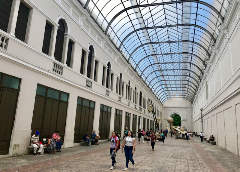
museum interior courtyard

An interior courtyard of The Museo Fernando García Ponce-Macay, which features contemporary art work of Mexican and regional Yucatan artists.

Is Mérida expensive?

For an American or European tourist, visiting Mexico is not expensive since the exchange rate is favorable. Of course, visitors can make their trip as expensive or as cheap as they wish. The truth is that it is a much cheaper city than others in the country, such as Mexico City or Monterrey.

Is Mérida safe?

In 2019, CEOWORLD magazine rated Mérida as the second safest city in the Americas, only surpassed by Quebec. It’s undoubtedly pretty safe and visitors and locals alike can walk around everywhere in the city with confidence. However, as in any medium-sized city, it’s advisable not to go out with expensive jewelry or large amounts of cash.

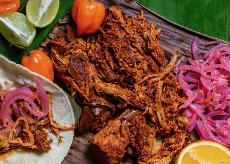
Cochinita Pibil is pit-roasted pork with citrus flavors, a traditional dish of the Yucatan Peninsula.

What should I eat in Mérida?

Yucatecan cuisine is famous throughout the country and it has flavors that make it distinct from those of other Mexican regions. Typical dishes such as cochinita pibil, panuchos, papadzules, relleno negro (black stuffing) or lime soup are among the delicacies that any visitor to the city must try. There are restaurants for all budgets. Some of the most iconic ones are La Tradición and La Chaya Maya. Foodies who love fine dining should visit K’u’uk and the restaurant at Rosas & Xocolate, one of the city’s prettiest boutique hotels.

Read More

Mazatlán Travel Guide

Mexico › Mazatlán
Updated: March 1, 2022

See Also

Mazatlán is one of Mexico’s most atmospheric resorts, a laid-back, historic city on the western, Pacific coast, and one of our favorite places to go for good seafood, sun and sand.

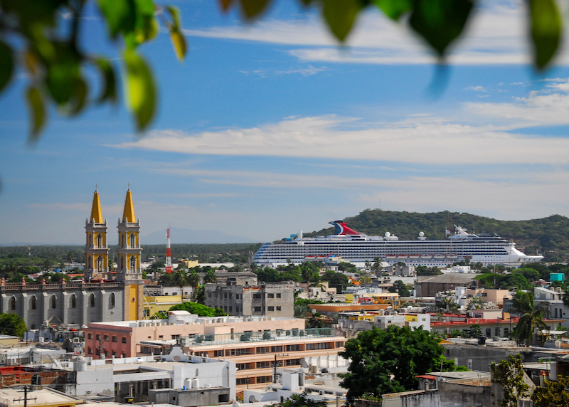
downtown with church and cruise ship

Downtown old Mazatlan with the cathedral and a cruise ship in the distance.

Frequently Asked Questions about Mazatlán

Where is Mazatlán?

Mazatlán is a city in Mexico, on the western, Pacific coast of the country in the state of Sinaloa. Mazatlán lies about 1030 km northwest of Mexico City, 220 km south of state capital Culiacán, and 440 km north of Puerto Vallarta. Non-stop flights to Mazatlán take 2 hours 40 minutes from Los Angeles, 2 hours 15 minutes from Tijuana, 1 hour 40 minutes from Mexico City and 1 hour 25 minutes from Monterrey.

How big is Mazatlán?

Mazatlán has a greater metro population of almost 490,000. The main city and busiest resort area stretches some 30km north to south along the Pacific coast. Pristine beaches and smaller resorts fan out either side of the central “Zona Dorada” (“Golden Zone”), the traditional hub for accommodation and tourist activities.

What is the history of Mazatlán?

Mazatlán claims an official foundation date of 1531, when the Spanish took control of the area, but nothing much happened here well into the 19th century. Initially little more than a base for smugglers and pirates, Mazatlán gained respectability when a Mexican customs office opened in 1828, and the city finally boomed as a mining port – author Herman Melville visited Mazatlán as a sailor in 1844. In the late 19th century, the city also attracted manufacturing and a large immigrant population – Germans opened the famous Cerveceria del Pacífico brewery in 1900. It wasn’t until the end of World War II that Mazatlán started to attract tourists, initially American sport fishermen (today it still operates the largest canneries and shrimp fisheries in the country). Writer Jack Kerouac passed through in 1952, writing about his visit in Lonesome Traveler. Mass tourism really took off in the 1970s with the development of the “Zona Dorada”, and in the last decade or so the city’s old town or “centro histórico” has been given an attractive facelift.

How do I get to Mazatlán?

Mazatlán is connected to the US and Canada by numerous non-stop flights, though many of these area seasonal; most flights will otherwise route through Los Angeles or Dallas/Fort Worth. Non-stop domestic flights link Mazatlán with Monterrey, Tijuana, Mexico City, and several smaller cities. There are no direct flights from Europe – most visitors travel through the US or Mexico City.

Within Mexico, first-class long-distance buses are an economical and comfortable alternative to flying – buses to Guadalajara (6–7 hours), Mexico City (14–15 hours), and Puerto Vallarta (7 hours 30 minutes) operate frequently (24 hours).

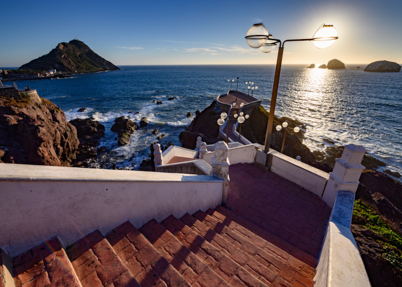
stairs down to ocean

Stairs down to a lookout point along the waterfront.

What are the options for airport transportation in Mazatlán?

Mazatlán’s International Airport lies some 20km south of the city center. Arrival can be quite chaotic – ignore the timeshare sales staff upon exiting and their offers of rides into the city. Look instead for the official “Taxi” desk and pay for transportation there – or arrange rides in advance with companies like Mazatlan Tours.

The cheapest transportation is provided by vans (or “colectivos”) that offer fixed rates to the old town and Zona Dorada – usually 125 pesos. This is a great deal, but note that if the van is full and your hotel happens to be the last stop, the trip can take well over 2 hours (it only takes 30 minutes by taxi).

Like most airports in Mexico, private taxis operate a monopoly here and rates are relatively expensive, ranging from US$25–60, depending on where the hotel is. The price will be fixed in advance at the Taxi Desk at the airport – there are no meters inside the taxis. The desk will accept US or Canadian dollars in addition to Mexican pesos, but payment is cash only. All the major car rental companies have desks at the airport.

Can I use Uber in Mazatlán?

Uber is available in Mazatlán (assuming phones have roaming, and the app works), and can offer convenience and much cheaper rates over traditional taxis. Most short trips in town range 30 to 45 pesos, with journeys between the Old Town and Zona Dorada around 65 pesos, and rides out to Cerritos around 100 pesos.

However, Uber drivers are legally forbidden to provide airport pick-ups. The local airport taxi drivers (as is typical in Mexico) are very territorial – even though Uber drivers are allowed to drop-off at the airport, most drivers will refuse for fear of reprisals. Within the city, taking Uber is usually fine.

Various other ride-sharing apps operate in Mazatlán, with Chinese-owned DiDi offering slightly cheaper rates, and Estonia-based Bolt another alternative, but we’d recommend sticking with Uber for first-time visitors.

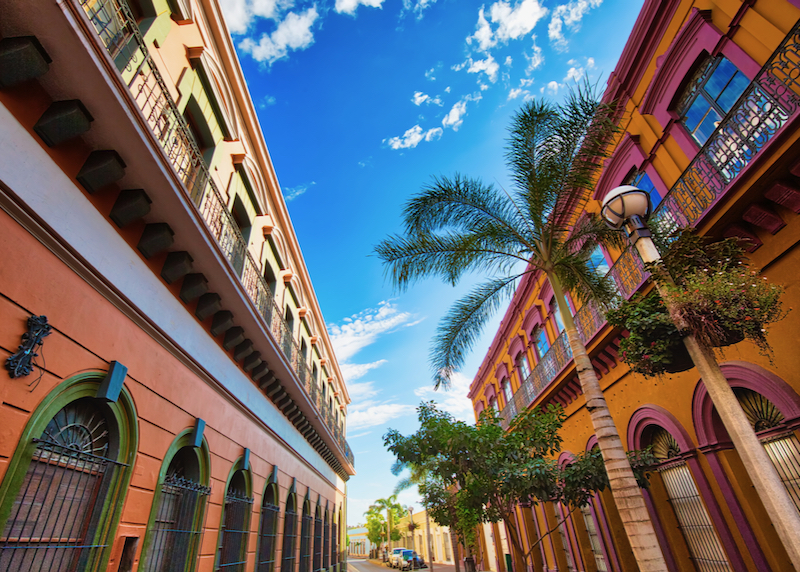
old historical buildings

Colorful old city streets in the historic city center.

Can I drive to Mazatlán?

We would urge caution in driving to Mazatlán. Driving down from the US border is relatively straightforward – the main highways are in good condition all the way. However, beyond the tourist centers, the states of Sinaloa and Sonora have a reputation for drug violence that makes driving some areas a potentially dangerous proposition – driving at night should be absolutely avoided. The drive from Mazatlán to Nogales on the border with Arizona on Hwy-15 is around 1170 km (727 miles) and 14 hours non-stop. Foreign vehicles also require a Mexican “Temporary Importation of Vehicle Permit”, arranged at the border or before departing.

Do I need a car in Mazatlán?

Public transport is incredibly prolific and cheap in Mazatlán making a car unnecessary (see below).

The Old Town is best explored on foot, and it’s easy to reach all the main beaches by bus or taxi.

How do I get around Mazatlán without a vehicle?

There are so many options to getting around Mazatlán without a car! Public transport is fun and cheap in Mazatlán. First-time visitors should try the pulmonías (a bit like souped-up golf carts but usually modified VW Beetles, blaring Mexican music). Fares depend somewhat on negotiation skills – rides between the Zona Dorada and Old Town usually cost around 150 pesos. Larger red pick-up trucks known as aurigas tend to be cheaper than this, and ideal for big groups – they take 8–10 people at a time – but again, negotiate the rate in advance.

Regular taxis (usually red or green) do not have meters but operate on a (very) rough fixed-rate system, though always confirm the price before getting in. Most short trips in town range 40 to 50 pesos, with journeys between the Old Town and Zona Dorada around 70–80 pesos (and 20 percent more at night). Uber tends to be a bit cheaper (see above).

City buses are a convenient and cheap alternative: the bus identified as “Sabalo-Centro” runs back and forth from the Marina in the north all the way down the seafront through the Zona Dorada and into the Old Town. The bus is air-conditioned and costs just 11 pesos.

waterfront yacht club

Sailboats and yachts in a marina along the waterfront.

When is the best time to go to Mazatlán?

Mazatlán is at its best between November and May when it’s sunny and very dry. In the summer (July to September) it can be very humid and very hot – it can also rain a lot, though the water is at its warmest for swimming and snorkeling at this time. October and November is a great time to visit – the rainy season is over, but the busy winter season has yet to pick up, so hotels tend to be cheaper.

Where should I stay in Mazatlán?

Most tourists in Mazatlán stay in the Zona Dorada, the “Golden Zone” fronting the main beaches – this is where the big resort hotels are, as well as a range of budget options. Alternatively, the restored Old Town (or centro histórico) has a lot more character – staying here, in boutique hotels or Airbnb apartments, means a longer journey to the beach but access to a lot more of Mazatlán’s cultural offerings – live music, theater, museums, bars, restaurants, and local markets. Larger and more isolated resorts lie to the north along Playa Cerritos and Playa Brujas in what is known as “Nuevo Mazatlán”.

What are the best beaches in Mazatlán?

Our favorite beaches in Mazatlán include the small beach on the Isla de la Venados (Deer Island), 2 km off the coast – all the tour operators in the Zona Dorada offer boat trips – and the Isla de la Piedra (actually a long peninsula), which boasts a long, sandy beach ideal for swimming, with several no-frills Mexican beach bars and restaurants. To get there, take a bus or taxi to the “Embarcadero” at the southern end of the Old Town, then catch a motorboat across the channel.

The primary tourist beaches that line the Zona Dorada – known as Playa Gaviotas and Playa Sábalo further north – are perfectly fine, often busy but clean and convenient for hotels and amenities. Further north the beaches are wilder and emptier; aim for Playa Cerritos or Playa Bruja (both accessible by bus) for a quieter experience.

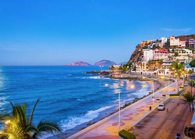
waterfront promenade at night

Waterfront promenade just after sunset.

Where to change money in Mazatlán?

The Mexican peso is the official currency in Mazatlán (often prefixed with a “$” sign), and though some hotels, restaurants, and vendors may accept US or Canadian dollars, most local businesses only deal in pesos. Try to use ATMs to withdraw peso cash in Mazatlán if possible (check with the bank before leaving to confirm it’s possible to use a debit card and how much they will charge – using credit cards can incur interest and foreign transaction fees). Credit cards are widely accepted, but cash is needed for buses, most taxis, and small purchases.

What are the best things to do in Mazatlán?

The best things to do in Mazatlán are connected with the beaches; swimming, surfing, sunbathing, and various watersports. Other pleasures include dining, drinking, and shopping, particularly in the resurgent Old Town. It’s worth strolling the historic streets around the Plaza Machado, taking in the 19th-century Teatro Ángela Peralta, the small but absorbing Museo Arqueológico (archeological museum), and Museo de Arte (art museum), with its displays of modern Mexican paintings and sculpture. The colorful stalls of the grand old city market, Mercado Pino Suárez, are also worth perusing.

Other highlights include viewing the world’s largest mosaic mural at the Mazatlán International Center; hiking up to the lighthouse (“El Faro de Crestón”) at the far southern edge of the city; enjoying a cocktail at historic Bar Belmar, overlooking Playa Olas Altas; and watching the cliff divers at “the Mirador”, on the seafront. For a bit more excitement tackle the multiple ziplines at Huana Coa Canopy Adventure, just outside the city (tours that include transport are sold all over town and in hotels). Mazatlán is also a great place to learn to surf – contact Jah Surf School.

What are the restaurants in Mazatlán like?

The restaurants in Mazatlán are pretty good, a mix of classic Mexican and international. In the Old Town, Casa Etnika sells handicrafts as well as Oaxacan coffee and snacks, while Topolo and El Aljibe de San Pedro are our go-to’s for high-quality Mexican cuisine. Asian-fusion specialist Water’s Edge Bistro is our overall favorite restaurant for a big night out. In the Zona Dorada we recommend Casa Loma for a romantic dinner, and Twisted Mama’s for international dishes, cocktails and nightlife.

Is Mazatlán expensive?

Everything is relative of course, but Mazatlán is one of Mexico’s more affordable resorts. Hotels tend to be reasonably priced, public transport is very cheap, and meals and activities won’t cost much – almost everything is priced in pesos, not US dollars.
Is Mazatlán safe?

Yes. Despite the state of Sinaloa being one of Mexico’s drug cartel hotspots, Mazatlán itself is safe for tourists to visit. The Zona Dorada, Old Town, and Malecón (seafront) are well-policed, even at night. We would advise not to travel outside the city alone (organized tours are OK), and to take the usual precautions.

Read More

Cabo Travel Guide

Mexico › Los Cabos
Updated: April 5, 2026

See Also

Los Cabos – or just “Cabo” – is a popular Mexican resort area at the tip of Baja California, and one of our favorite places to go in Mexico for sea and sun. With a coastline that takes in the Pacific Ocean and Sea of Cortez, Cabo is best known for its fine beaches, luxury hotels, beautiful desert scenery, surfing, and vibrant beach, dining, and nightclub scene.

cabo aerial view

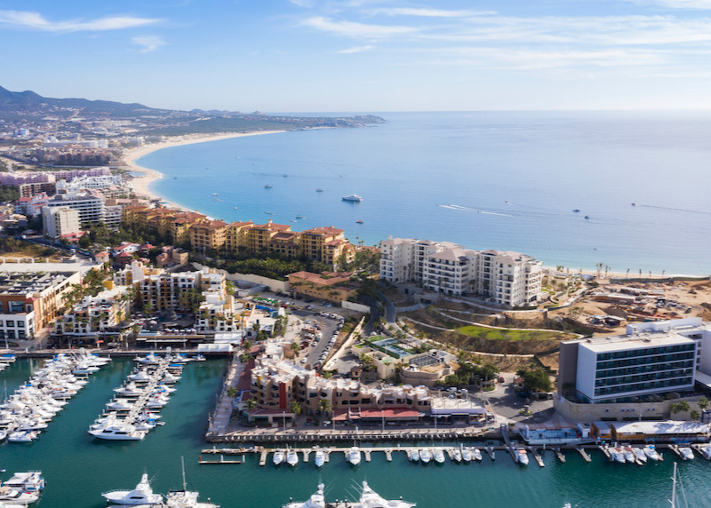
Aerial view of Medano Beach in Cabo San Lucas.

Frequently Asked Questions about Los Cabos

Where is Los Cabos?

Los Cabos is a municipality at the southern tip of the Mexican state of Baja California Sur. Bordering the Pacific Ocean to the west, and Sea of Cortez (or Gulf of California) to the east, it comprises the two resort towns of Cabo San Lucas and San José del Cabo, separated by the 32 km “Corridor” of resorts and posh condos.

Cabo San Lucas lies about 160 km south of La Paz, and 1625 km south of Tijuana and the US border. Non-stop flights to Los Cabos International Airport take just over 3 hours from San Francisco, 2 hours 35 minutes from Houston, 2 hours 15 minutes from Los Angeles, just over 2 hours from Mexico City and Tijuana, and 1.5 hours from Guadalajara.

How big is Los Cabos?

The population of Los Cabos has grown significantly and is now estimated at over 350,000 for the entire municipality. Cabo San Lucas has a population of around 106,000, while San José del Cabo has around 105,000 inhabitants.

What is the history of Los Cabos?

Originally the home of the indigenous Pericú people, the first official Spanish attempt to colonize Los Cabos began in 1730. In that year San José del Cabo was founded as a Catholic mission by Jesuits, on the site of a Pericú village – it was destroyed in the Pericú Revolt four years later, and over the next hundred years, the location of the mission and settlement was re-located several times. Meantime, diseases virtually wiped out the Pericú.

In the 19th century, San José developed into a small port and agricultural center, while Cabo San Lucas remained a tiny village frequented by pirates and smugglers. In the 1940s writer John Steinbeck sailed along the Baja coast, recording his journey in The Log from the Sea of Cortez – he called Cabo San Lucas a “sad little town”. There was a tuna cannery here and little else, and the road connecting the two settlements wasn’t finished until 1970. In the 1980s everything changed when the Mexican government began developing the region as a major international resort and cruise destination – today millions of North Americans vacation here annually.

How do I get to Los Cabos?

Los Cabos International Airport (SJD) is connected to the US and Canada by numerous non-stop flights; flights take anywhere from 2 hours 15 minutes to 8 hours, depending on the destination. Most domestic flights link Cabo with Mexico City, Guadalajara, and Tijuana.

Because of its relatively remote location, getting here overland can be very time-consuming. First-class long-distance buses run down the Baja peninsula from Tijuana (at least 28 hours to Cabo San Lucas) via La Paz (2 hours 30 minutes to 3 hours).

Santa Maria beach Cabo

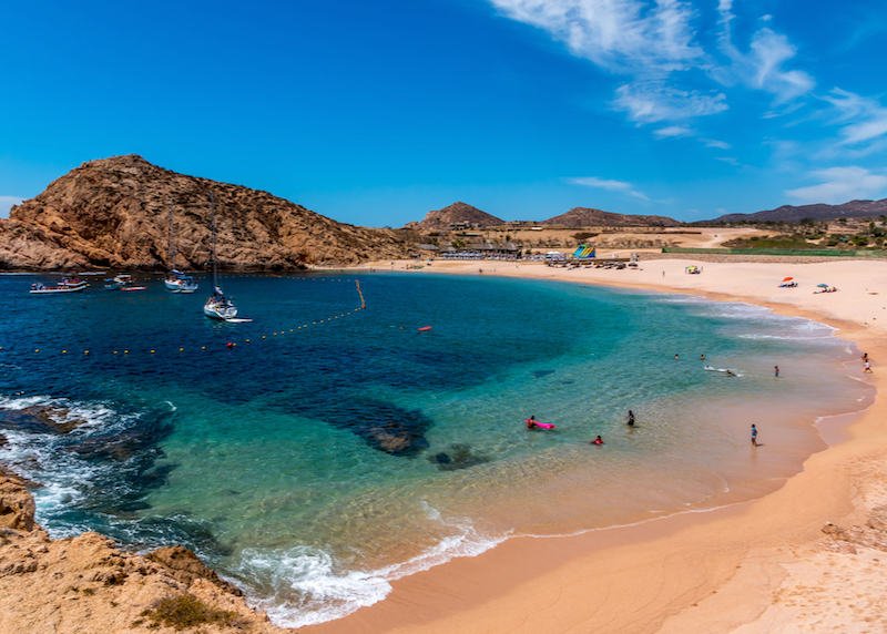
Beautiful Santa Maria Beach is a sheltered beach with calm swimming and snorkeling areas.

What are the options for Cabo airport transportation?

Los Cabos International Airport lies 11km north of downtown San José del Cabo and about 45km from Cabo San Lucas. All the major car rental companies have desks here; otherwise, reserve a taxi or shared minibus in advance with Transportistas Josefinos, Cabo Transfers, or Los Cabos Airport Shuttle. Shared shuttles cost roughly $15 to $40 per person, while private SUVs to Cabo San Lucas are usually around $100. Airport taxis are available on arrival but are much more expensive than pre-booked options.

Can I use Uber in Los Cabos?

Uber is widely used and legal in Los Cabos for getting around town or going to the airport, but pickups at the airport (SJD) remain restricted. While you can easily take an Uber from your hotel to the airport, the National Guard often prevents Uber drivers from picking up arriving passengers at the terminal because it is a federal zone. If you want to use Uber from the airport, you typically have to walk a considerable distance off airport property to meet the driver. For arrivals, I highly recommend pre-booking a private shuttle instead to avoid the hassle.

Can I drive to Los Cabos?

It’s possible to drive to Los Cabos. Driving down from the US border is relatively straightforward, and plenty of Americans and Canadians take their own vehicles – the main highway (Hwy 1) is generally in good condition and fairly safe, though driving at night should be strictly avoided due to wandering livestock and narrow shoulders. There are several Mexican army checkpoints along the way, but tourists are usually waved through quickly.

It’s important to fill up whenever you see a gas station (especially in the central desert) and plan accordingly. The drive is over 1,625 km (1,010 miles) and takes around 24 hours of actual driving time – most people break the journey into three or four days. Foreign vehicles do not need a Mexican “Temporary Importation of Vehicle Permit” as long as they stay within the Baja peninsula.

If renting a vehicle, it’s much easier to do this in Mexico, as taking US rental vehicles across the border is difficult and requires very specific insurance.

Do I need to rent a car in Los Cabos?

It is not necessary to rent a car in Los Cabos if you plan on staying mostly at your resort or in the main towns. However, if you want to explore the “East Cape,” visit remote surf breaks, or take a day trip to Todos Santos on your own schedule, a car is very helpful. Car rental is straightforward at the airport, and the highway between the two towns is easy to navigate, though traffic in Cabo San Lucas can be heavy.

lands end lovers beach

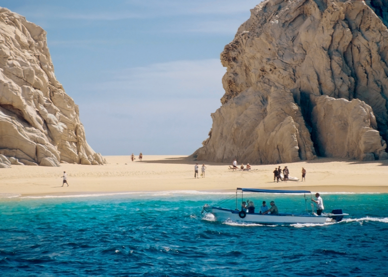
The gorgeous “Land’s End” Beach at the southern tip of Baja is a favorite spot for visitors.

How do I get around Los Cabos without a vehicle?

Taxis, Uber, or local buses are the easiest ways to get around. The “Ruta del Desierto” (purple and yellow buses) runs along the Corridor between Cabo and San José every 10 to 15 minutes for a few dollars. Taxis are always available but are quite expensive; a trip between the two towns can cost $60 or more. Uber is a much cheaper alternative for trips between towns or within the marina area, though they may not be allowed to enter some resort gates for pickups.

When is the best time to go to Los Cabos?

The best weather is from November through May. Whale-watching season typically peaks in January and February. July through September can be extremely hot and humid, and this is also the primary hurricane season. Skip Christmas, Easter (Semana Santa), and the peak of Spring Break (March) to avoid the largest crowds and highest prices.

Where should I stay in Los Cabos?

The coast of Los Cabos is divided into three main sections:

Cabo San Lucas is the heart of the action. It is home to the main marina, luxury malls, and the famous nightlife. This is where you stay if you want to be within walking distance of bars and the swimmable Medano Beach.

San José del Cabo is the more traditional, colonial-style town. It is known for its Art District, historic church, and a more sophisticated dining scene. The “Zona Hotelera” here has many large beachfront resorts, though the ocean is often too rough for swimming.

The Corridor is the 32km stretch of highway connecting the two. This is where you find the most exclusive luxury resorts, like Las Ventanas al Paraíso and One&Only Palmilla. It’s quiet and secluded, but you’ll need transportation to get to either town for dining or shopping.

lovers beach sand

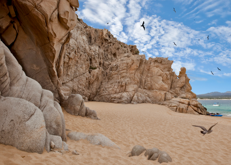
Lover’s Beach at Land’s End.

What are the best beaches in Los Cabos?

Many beaches in Cabo are not safe for swimming due to strong undertows and steep drop-offs, especially on the Pacific side. My favorites for swimming and snorkeling include:

Playa el Chileno: 15km from Cabo San Lucas, very clean with great facilities and calm water.
Bahía Santa María: A beautiful protected cove perfect for snorkeling with tropical fish.
Playa El Médano: The main swimmable beach in Cabo San Lucas, lined with beach clubs and very lively.
Playa del Amor (Lover’s Beach): Located at Land’s End near the famous Arch, accessible only by water taxi.
Playa Acapulquito: A great spot for beginner surfers near San José del Cabo.

Where to change money in Los Cabos?

The Mexican peso is the official currency, and I recommend using it for the best value. While US dollars are widely accepted, the exchange rate offered by shops and taxis is usually poor. Use bank ATMs (Santander, Banorte, BBVA) to withdraw pesos for the best rate. Credit cards are accepted at almost all hotels and major restaurants, but you will need cash for the bus, small taco stands, and tips.
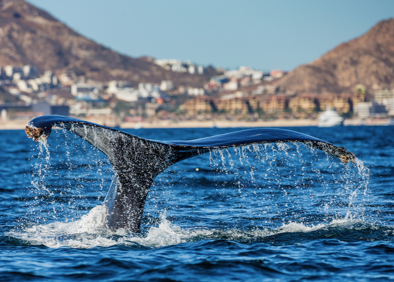
humpback whale tail

See humpback whales and other amazing marine mammals up close on a whale watching tour.

What are the best things to do in Los Cabos?

The ocean is the main attraction. Taking a boat trip to “El Arco” (The Arch) is a must-do. From December to April, whale watching tours are spectacular. For adventure, Cabo Adventures offers zip-lining and camel rides, while Cabo Sky Tours provides incredible aerial views via ultralight.

In San José del Cabo, the Art Walk takes place every Thursday evening from 5:00 PM to 9:00 PM between November and June. It’s a great time to explore the galleries and enjoy the town’s atmosphere. For a day trip, the “Pueblo Mágico” of Todos Santos is about an hour away and offers a cool, artsy vibe and great surfing.

What are the restaurants like in Los Cabos?

The dining scene is world-class, ranging from humble taco stands to high-end farm-to-table spots.

In Cabo San Lucas, we love Bar Esquina for its great vibe and fusion menu, and Taquería El Paisa for authentic, cheap tacos. For a splurge, El Farallon at the Waldorf Astoria offers cliffside dining that is hard to beat.

In San José del Cabo, Mi Cocina in the Casa Natalia hotel is excellent. For a unique experience, head just outside town to “Flora Farms” or “Acre” for farm-to-table dining in a lush garden setting.

Is Los Cabos expensive?

Yes, it is one of the most expensive destinations in Mexico. However, you can save money by using Uber or the local bus instead of taxis, eating at local taquerías away from the marina, and booking accommodation in downtown San José or Cabo San Lucas rather than the luxury beachfront resorts in the Corridor.

Is Los Cabos safe?

Yes, Los Cabos remains one of the safer tourist regions in Mexico. The U.S. Department of State typically classifies Baja California Sur as Level 2 (Exercise Increased Caution), which is the same rating given to many European countries. Most crime is non-violent and related to petty theft. Use common sense: don’t leave bags unattended on the beach, stick to well-lit areas at night, and use the hotel safe for your passport and extra cash.

Guanajuato Travel Guide

Mexico › Guanajuato
Updated: March 1, 2022

See Also

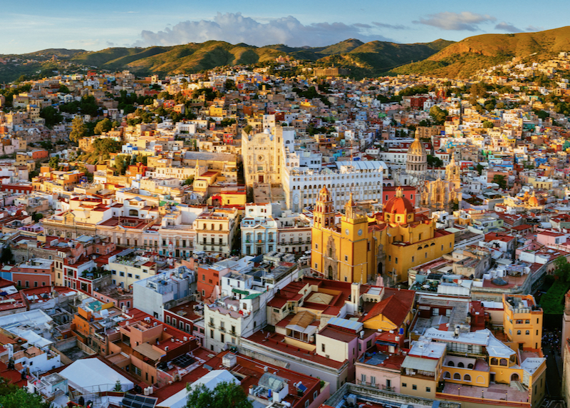
downtown skyline

Dense and vibrant downtown Guanajuato.

Guanajuato: The Basics

Where is Guanajuato?

Guanajuato is the capital of its own state in a central region of Mexico known as the Bajío, around 360km northwest of Mexico City. Its central location makes Guanajuato a great jumping-off point for trips to the historic silver towns of Mexico, from San Miguel de Allende to Querétaro. The population of Guanajuato is around 172,000.

What is Guanajuato famous for?

Guanajuato is famous for gold and especially silver: in the colonial period the mines of Guanajuato made it one of the wealthiest cities in the world. It’s also famous in Mexico for its role in the War of Independence, when national hero Miguel Hidalgo stormed the Spanish-held Alhóndiga de Granaditas with the help of the legendary “El Pípila”, a local miner. For travelers, Guanajuato is most famous for its sensational location, crammed into a narrow ravine, and its gorgeous colonial architecture. Guanajuato is also known for its enticing restaurants and bars, historic churches, theaters, and mine museums, but one of the best things to do in Guanajuato is to just wander the streets and squares, enjoying the scene. Its also a popular destination for travelers seeking to study Spanish, with a handful of excellent language schools.

What is the best month to go to Guanajuato?

Guanajuato boasts a year-round temperate climate, with the driest and sunniest months Nov–April. Rain is heaviest July to August, though temperatures rarely rise above 30°C (84°F) in summer. The best time to visit Guanajuato is February through early through March when the weather is warm but not overly hot, the days generally dry, and crowds are at a minimum.

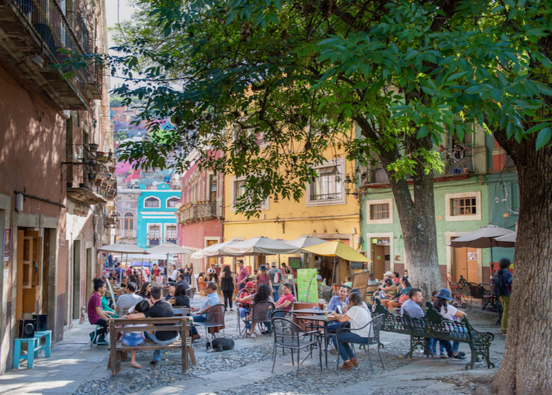
cafe streets

Downtown is filled with outdoor cafes and vibrant pedestrian only streets.

Is Guanajuato safe?

In a word, yes, Guanajuato is safe. The drug-related violence that has blighted some parts of Mexico has largely skipped Guanajuato city itself, and it remains a relatively safe, family-friendly university town. Travelers to Guanajuato, including solo female travelers, will feel safe as long as normal precautions are taken. US State Department travel advisories apply to the southern parts of Guanajuato State only, where cartels do operate.
Where to stay in Guanajuato?

Guanajuato is best explored on foot so staying in the historic center of the city makes the most sense – and is far more atmospheric than lodging in the outskirts. Our favorites include the colonial-style Edelmira Hotel Boutique, El Mesón de los Poetas, and Hotel San Diego, overlooking central Jardín de la Unión. For stellar views consider Casa Zuniga, high above the city next to the funicular.

Planning a Guanajuato Itinerary

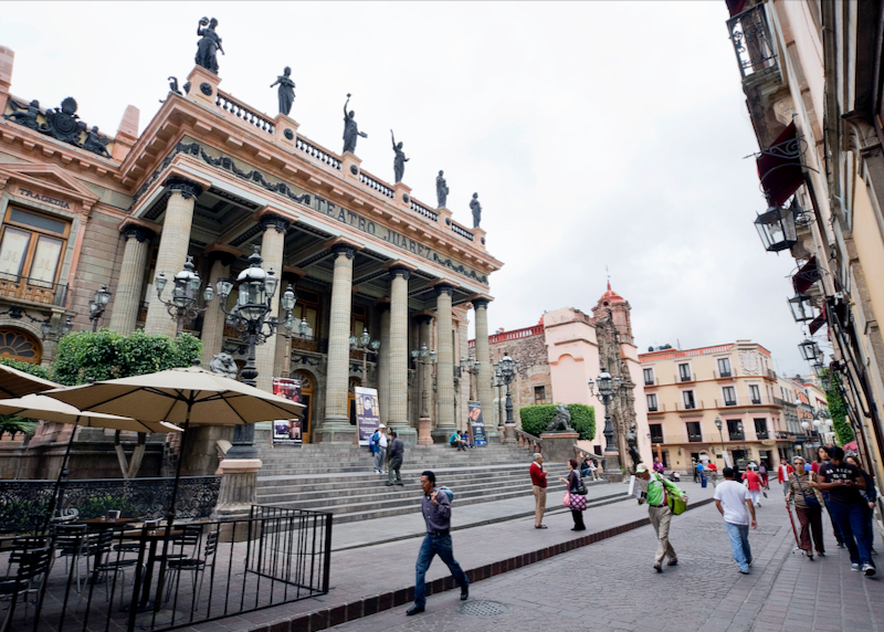
Juarez theater

The famous Juarez Theater, a landmark building in downtown.

One Day in Guanajuato

Hike or take the funicular up to the Pípila Monument, then stroll through the old city, from the Jardín de la Unión to Mercado Hidalgo. Make time for the Teatro Juárez and Museo Regional de Guanajuato.

Two Days in Guanajuato

Add a visit to the Museo de las Momias and Museo Casa Diego Rivera, a meal at Casa Mercedes and an afternoon in La Valenciana.

Three Days or More in Guanajuato

Visit the Museo Ex-Hacienda de San Gabriel de Barrera and Museo Iconográfico del Quijote, then take a bus trip out to the Cristo Rey.

Visiting Guanajuato: How to get there

• Airport: Guanajuato’s airport – aka Bajío International Airport – lies 30km west of Guanajuato city. Typically there are direct flights to/from several North American cities including Chicago (5 hours), Dallas (2 hours), Houston (two hours), and Los Angeles (three hours), as well as numerous flights to Mexico City (1hr).

• Taxis: From the airport, taxis operate a fixed-rate fare system, with rides direct to central Guanajuato (45min) around 485 pesos.

• Buses: Comfortable, first-class buses link Guanajuato with Guadalajara (4 hours), Mexico City (5 hours), Querétaro (2hr 30min), and San Luis Potosí (3 hours) throughout the day. The main bus station (“Central de Autobuses”) is 6km west of the center – buses can be a hassle with luggage and the easiest option is to take a taxi. Set the price before getting in (around 60 pesos to the center).

• TIP: Taking a callejóneada is one of the most fun things to do in Guanajuato. Groups of students and musicians – dressed like medieval minstrels, playing guitars – lead groups through the historic alleys of the city, singing and joking. Tours last around 1 hour 30 minutes, and include a ceramic “porrón” (traditional drinking vessel) filled with orange or apple juice (booze is discouraged nowadays). Spanish-speakers will get the most out of the jokes and the history, but the music works in any language.

downtown tunnel system

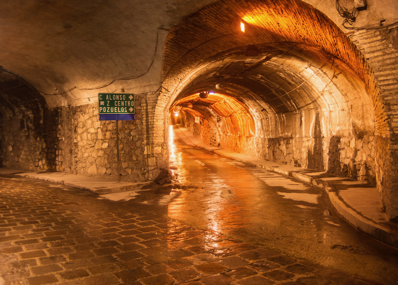
Beneath the city is a unique subterranean system of tunnels for pedestrians and vehicles, originally created to service the gold and silver mines.
The 20 Best Things to do in Guanajuato

1. Take the Funicular up to the Pípila Monument

The best way to start a visit to Guanajuato is by soaking up the mesmerizing views from the Monumento al Pípila, high on the hillside above the old town’s colorful blend of colonial houses and churches. The monument commemorates local miner and independence hero Juán José Martínez, aka “El Pípila”. Getting up here is half the fun – the steep climb up takes about 20 minutes, or there’s the funicular, a simple two-car cliff railway (one-up, one-down) that glides up the slope in a few minutes.

2. Drinks at Jardín de la Unión

Jardín de la Unión, Guanajuato’s historic plaza, is a charming space shaded with trees. Lined by cafés and bars such as popular Luna, it’s the perfect spot for an early evening drink – local bands and musicians often play outdoors here at dusk.

3. Museo de las Momias

It’s not for everyone, but the Museo de las Momias – “Museum of the Mummies” – is Guanajuato’s kookiest sight. The museum holds a macabre collection of mummified human corpses, displayed in glass cases. The withered remains are remarkably well preserved, despite many of them being over 100 years old, and many retain original clothing. The mummies come from a local cemetery, where space constraints mean that bodies are removed from crypts after five years if annual payments are not made (they are usually cremated or transferred to a common grave thereafter).

4. Museo Casa Diego Rivera

Mexico’s most celebrated muralist was born in this house in Guanajuato in 1886, now preserved as a fascinating museum. Diego Rivera only lived here until the age of six, but the museum makes the most of the connection, with the lower floor furnished in a period 19th-century style, and the upper floors displaying Rivera’s works, mostly sketches and early paintings.

hidalgo market

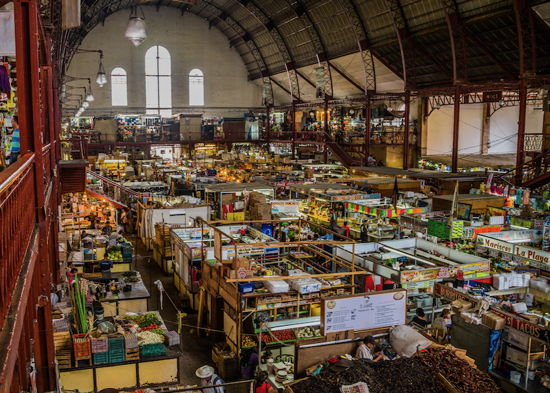
Hidalgo Market, a vibrant spot for handicrafts and food.

5. Eating at Mercado Hidalgo

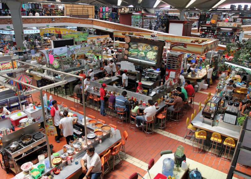
Guanajuato’s historic indoor market was built in 1910 and is still packed with all sorts of stalls, from fresh fruit to local crafts and cheap garments. Along with the adjacent Mercado de Gavira, it’s also a tasty, cheap place to eat, with everything from tacos and tortas to locally celebrated “enchiladas mineras” and birria (goat or mutton stew) on offer.

6. Teatro Juárez

Guanajuato’s grandest building is Teatro Juárez, a Neoclassical theater completed in 1903, fronted by slim Doric columns and topped with bronze statues of the Greek muses. It still hosts performances, but it’s also possible to take a tour of its lavish interior, the main auditorium decked out in a rich Neo-Mudejar (Moorish) style (commentary is likely to be in Spanish).

7. Museo Regional de Guanajuato (Alhóndiga de Granaditas)

For many Mexicans, this museum is the most significant in all Guanajuato thanks to its role in the Mexican War of Independence. It was here in 1810 that Miguel Hidalgo – aided by local hero “El Pípila” – vanquished the pro-Spanish garrison. Back then the building was used a grain warehouse and part-time prison. After a short siege, all the defenders (some 300 men) were slaughtered. Today the museum chronicles the history of Guanajuato from pre-Columbian times to the 1910 Revolution, while the stairwells are decorated in murals created by local artist José Chávez Morado in the 1950s and 1960s, depicting scenes from Mexican history.
8. Have a meal at Casa Mercedes

Chef Jesús Cárdenas helms one of the region’s best restaurants, with a menu of high-quality dishes inspired by his childhood in Guanajuato. Casa Mercedes is perfect for a last night splurge in the city, though it’s essential to make reservations.

9. La Valenciana

For an easy break from the city, take a taxi or bus over the hills north of Guanajuato to the colonial village of La Valenciana. The local church is a gorgeous example of 18th-century Mexican Churrigueresque style – every inch is covered in gilded sculpture, painting, or ornate plasterwork. But the main attraction here is the chance to venture into Guanajuato’s historic silver and gold mines. The hills were once honeycombed with tunnels and there are several privately run ventures offering a peek underground. The best are the Bocamina San Cayetano, which offers thirty-minute tours of the tunnels, and Bocamina San Ramón, featuring a small museum and tours into another mineshaft, some 50 meters into the hill.

10. Callejón del Beso

Guanajuato’s most romantic sight is the Callejón del Beso (“Alley of the Kiss”), so-named because it’s supposedly narrow enough (just 69cm/27 inches at one point) for residents to lean out of their windows and kiss each other. The alley has a tragic legend attached to it: Doña Ana and Don Carlos were in love but forbidden to see other by zealous parents. Doña Ana’s family lived in the Callejón del Beso, and the story goes that Don Carlos bought the house opposite so the two could secretly hold hands at night. However, one evening Ana’s father caught them and was so angry he murdered his daughter on the spot – Carlos was left grasping her dead hand. Couples who kiss while standing on the third step of the alley are supposedly guaranteed seven years of happiness together.

11. Museo Ex-Hacienda de San Gabriel de Barrera

A couple of kilometers west of the center lies one of Guanajuato’s grandest colonial mansions, built for the wealthy Barrera family in the late 17th century. The family chapel and house interiors have been restored in period style, but the blossom-filled gardens, designed in a number of international styles, are just as enticing. It’s best to take a taxi here.

12. Museo Palacio de los Poderes

It’s well worth touring the old Guanajuato state legislature building – the Palacio Legislativo – now converted into the “Museum of the Powers”. Completed in 1908 in a grand Neoclassical style, all its official chambers and rooms have been beautifully restored with original wooden furniture, mosaics, paintings, and heaps of marble. The lower floors act as space for temporary art exhibitions and the Guanajuato Library.

13. Museo Conde Rul

Next door to the Museo Palacio de los Poderes, the similarly ornate Casa del Conde Rul y Valenciana was once a lavish mansion, built for wealthy mine owner Don Diego Rul in 1802. Today it’s a museum hosting travelling exhibitions of mainly Mexican and Latin American art, though the carefully restored interiors are well worth a peek in their own right.

14. Basílica de Nuestra Señora de Guanajuato

The city’s premier church lies on central Plaza de la Paz, a large red and tangerine-colored edifice dedicated to the patroness of the city (the Virgin Mary, here in her incarnation as Nuestra Señora de Guanajuato). Completed in 1796, the most sacred object inside is the central wooden statue of the Virgin, a 16th-century gift to the city from the Spanish monarchs.

15. Museo Iconográfico del Quijote

This quirky little museum is dedicated to Don Quixote, the iconic Spanish literary character created by Miguel de Cervantes in the 17th century. The collection includes an array of paintings (including an original a Dalí print), murals, tapestries, sculptures, ceramics, glassware, chess pieces, playing cards, and tobacco pipes adorned with images of the hapless knight errant.

church ceiling

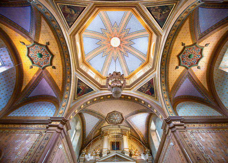
The gorgeous interior of the Church of Belen, outside of the popular Hidalgo Market.

16. Templo de San Diego

This ornately decorated 18th-century church faces the Jardín de la Unión, notable for its pink sandstone Churrigueresque-style façade and collection of oil paintings inside. It’s dedicated to San Diego de Alcántara, aka Didacus of Alcalá, a 15th-century Spanish missionary to the Canary Islands.

17. Museo del Pueblo de Guanajuato

This absorbing museum of local art and historical artifacts stands next to the main Guanajuato university building. It was once another posh mansion, this one built for the Marqués de San Juan de Rayas in the 18th century, but enhanced with murals by José Chávez Morado in the 20th century.

18. Museo Olga Costa-José Chávez Morado

The former home of Mexican muralist José Chávez Morado and his German painter wife Olga Costa is now a beautifully maintained museum filled with art objects collected by the couple (there are only a few items by the artists themselves). Everything from majolica ceramics, and seventeenth-century French furniture, to Persian rugs and tapestries. Take a taxi or walk from the Jardín de la Unión (30 min).

19. Templo de La Compañía

Guanajuato is crammed with elegant colonial churches, but this is one of the best, built by the Jesuits and consecrated in 1765 (the Jesuits were kicked out of Mexico just two years later). Today the façade is a highly ornate example of the Churrigueresque style, while the clear glass in the dome was added in 1884.

20. Cristo Rey

The Cristo Rey – a 20m-tall bronze statue of Jesus, a bit like the famous one in Rio – tops the 2661m-high Cerro de Cubilete, 20km west of the city. It dominates the surrounding hills and plains, and provides sensational, albeit hazy views. Tours to the statue are offered all over Guanajuato, but there are also public buses from the central bus station for independent trips.

Read More

Guadalajara Travel Guide

Mexico › Guadalajara
Updated: March 1, 2022

See Also

Frequently Asked Questions about Guadalajara

Guadalajara cathedral

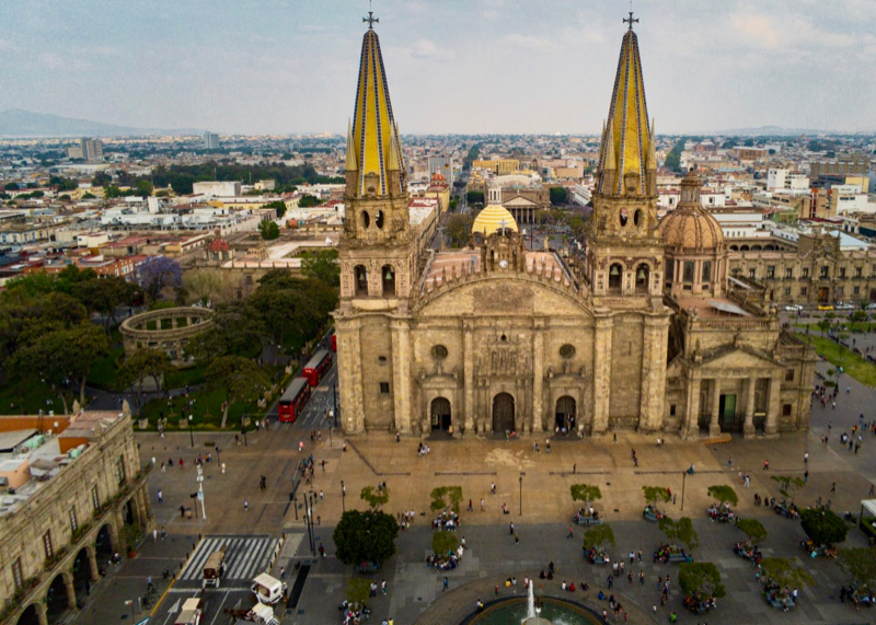
The iconic Guadalajara Cathedral with its unique 2 spires sits in the main plaza in downtown.

Where is Guadalajara?

Guadalajara is the capital of the state of Jalisco, in western Mexico. It is located in the central part of the state, in the Atemajac Valley, at an altitude of 5150 ft. (1570 meters). Eight municipalities make up its metropolitan area, which is the second-largest in the country, right after Mexico City.

How big is Guadalajara?

The population of Guadalajara is around 4,500,000 inhabitants, including its metropolitan area, distributed in an area of 1698 square miles (2734 square kilometers). Without counting the other seven municipalities, Guadalajara measures 94 square miles (151 square kilometers) and its population exceeds 1,500,000 inhabitants.

What is the history of Guadalajara?

In 1530, the Spanish Conquistador Nuño Beltrán de Guzmán decided to conquer the region of Guadalajara. Once he achieved this, he named it Guadalajara in honor of the Spanish city where he was born. The colonization process was long and complex due to the indigenous resistance and it wasn’t until 1542 that the new settlement finally took hold of the place it now occupies in the Atemajac Valley. In 1560, it became the capital of Nueva Galicia, now called Jalisco.

mariachi musicians serenading diners

Mariachi music originated in the region around Guadalajara, and is one of 7 Mexican cultural traditions recognized by UNESCO.

How do I get to Guadalajara?

Guadalajara has an international airport located 10 miles (16 kilometers) away from the city center. It’s the third airport with the most air traffic in the country (after Mexico City and Cancun). There are daily flights from various parts of Mexico, the United States, and Central America. Transfer time from the airport to the city center by taxi is around 35 minutes.

When is the best time to go to Guadalajara?

Guadalajara has a privileged climate. The average maximum temperature in the year is 80°F (27°C) and the minimum is 51°F (11°C). The rainy season begins in late June and ends in early October. Even though the city’s tabachines and jacaranda trees aren’t in full bloom in the winter, this is a good time to explore the city on foot without worrying about rain or excessive heat.

What neighborhoods should I visit in Guadalajara?

tlaquepaque walkway

Tlaquepaque is a popular neighborhood for both locals and tourists, filled with restaurants and art galleries, and a pedestrian only central area.

Guadalajara exemplifies tradition and modern-day life at the same time. There are neighborhoods where visitors can feel the timeless flavor of tequila and mariachi music, and others where they can breathe avant-garde through art, design, and gastronomy. ‘Musts’ include visiting the buildings in the historic center, the markets in Mexicaltzingo and Santa Tere, the galleries and bars in the Americana neighborhood, as well as strolling through Tonala and Tlaquepaque, two traditional neighborhoods on the outskirts of the city.

Where should I stay in Guadalajara?

The historic center of Guadalajara combines iconic buildings, good nightlife, and access routes to the rest of the city. Travelers looking for luxury and exclusivity will find that Puerta de Hierro, home to the business district, is the right choice. Host to renowned events like the International Book Fair, Expo Guadalajara —the city’s main convention center— is a magnet for visitors. There are plenty of accommodation options for all budgets in its surrounding area, known as Zona Expo. The Americana neighborhood has an appealing hipster vibe where younger, or young at heart, visitors might feel right at home staying at Airbnbs.

How do I get around in Guadalajara?

Guadalajara has several main roads that cross the city. Transportation options include light rail, minibus, buses, bicycle rental, and taxis. It’s best to request taxis through hotel concierges or restaurant reception staff. Transport companies also operate in the city through apps such as Uber and Cabify.

What are the best things to do in Guadalajara?

agave fields in tequila Jalisco

Visiting the agave fields and distilleries in Tequila on the outskirts of Guadalajara is a popular day trip.

Guadalajara has many interesting buildings worth visiting but some unmissable ones are Hospicio Cabañas, Degollado Theater, and the Expiatory Temple. The town’s culinary offer is impressive and Chapultepec Avenue is a good example of it. With bars lining both sides of the street, visitors can breathe in its enchanting atmosphere, even late at night. And to fully experience this thoroughly Mexican city, visitors would do well to sit in a bar in Tlaquepaque and listen to live mariachi music while sipping a jarrito with tequila.

How many days should I spend in Guadalajara?

Guadalajara is a great city in every sense, and its essence can’t be absorbed in less than four days. One or two days should be allocated to go sightseeing around the historic center, another one to explore iconic places such as Tlaquepaque, and one more to discover its artistic side by popping into galleries, designer shops, and restaurants in the Americana neighborhood. Travelers wishing to visit tourist attractions in the surrounding areas, such as Tequila or Chapala, will need to allocate at least a week to the trip.

What currency is used in Guadalajara?

In Guadalajara, as in the rest of the country, the currency is the Mexican peso. In 2020 the average exchange rate has been about 20 pesos per US dollar. There are foreign currency exchange agencies in the airport but the best rate is usually offered by the bank, so it’s advisable to pay with a credit card whenever possible and withdraw cash from an ATM. Carrying small bills is useful because many smaller establishments don’t accept cards. The same is true for markets, taxis, and street vendors.

Should I tip in Guadalajara?

In Guadalajara, as all over Mexico, waiters’ salaries are generally low, so tips are a fundamental part of the hospitality industry. The usual range is between 10 and 15%, but if service has been extraordinary, that percentage can be increased. In hotels, it’s also common to leave some bills to the housekeeping staff at the end of the stay. Unlike in the United States, it is not customary to tip taxi drivers in Mexico.

San Juan De Dios market

San Juan de Dios market in downtown is the largest indoor market in Latin America, covering 40,000 sq meters, filled with endless clothing stalls and a huge interior food court.

Is Guadalajara expensive?

Being the second-largest city in the country, Guadalajara’s prices are above those of the rest of Mexico, but also due to its size, it adapts to all budgets. As in all large cities, prices fluctuate from one area of the city to another, so it will not cost the same to buy handicrafts in Zapopan as in less touristy Juanacatlán. For travelers arriving from the United States, Europe, or Australia, it will not feel like an expensive city.

Is Guadalajara safe?

Like any great metropolis, Guadalajara is a city where crime is present. It’s best to carry money in a front pocket or crossbody bag, and going into sketchy neighborhoods should be completely avoided. To travel long journeys, especially at night, it’s best to call a taxi or Uber instead of walking back to the hotel or Airbnb.

What should I eat in Guadalajara?

Guadalajara has a culinary offer that will make the most demanding palates fall in love. Foodies will revel in the signature cuisine at Alcalde and D’Franck, the interesting fusions at Anita Li and Bruna, and local food staples such as tortas ahogadas (drowned sandwiches) and carnes en su jugo (meats in their juice). Karne Garibaldi, a restaurant that serves this specialty, holds the Guinness Record for the fastest service in the world.

Read More

El Tajín Travel Guide

Mexico › El Tajín Travel Guide
Updated: March 1, 2022

See Also

El Tajín is the most spectacular archeological site on Mexico’s Gulf Coast, and one of our favorites. It’s best known for its unique “niche” pyramids and flying voladores.

pyramid stairs

Amazing stone work on the pyramids of El Tajín.

Visiting El Tajín – Tips & Info

  • Allow around 3 hours to visit the ruins
  • The ruins are open daily 9am to 5pm and cost 80 pesos to visit
  • Hire an official guide (once inside the entrance), or obtain a comprehensive written guide before touring the site, as there are very few signs in English.
  • Guides charge around 400 to 500 pesos depending on the length of the tour – non-Spanish speakers should make sure their English is good before paying.
  • The pyramids and ruined structures are all off-limits – it’s only possible to walk around them, not on or up them
  • Local vendors sell snacks, drinks and handicrafts outside and inside the site – bring peso cash for snacks and drinks, but skip local specialties such as vanilla and honey and buy far better quality items in the main market back in Papantla.
  • Visit the museum at the El Tajín entrance first to see carvings, murals and bits of pottery and statues salvaged from the ruins.

Visits to the site itself begin at the Plaza del Arroyo, once the city’s market square, surrounded by four pyramids (Buildings 16, 18, 19 and 20), which were once topped by temples. Building 16 features El Tajín’s distinctive style, its tiers filled with regularly spaced niches, like a giant stepped cabinet. Just to the north, the Central Zone features the wide avenue of the South Ball Court (“Juego de Pelota Sur”), smothered with bas-relief sculptures, and the famous Pyramid of the Niches (“Pirámide de los Nichos”), its six primary receding tiers punctuated with 365 mysterious niches. Nearby is the Building of the Paintings (“Edificio de las Pinturas”), a palapa roof sheltering its relief carvings and painted murals.

Beyond here lies the raised Tajín Chico area, once the home of the city’s elite, though only parts of the once grand structures survive. Buildings B and C are the most impressive and probably served as palaces. The Building of the Columns (“Edificio de las Columnas”) stands on a rise above Tajín Chico, with more bas-reliefs on its pillars.

From Tajín Chico you can walk down to the Great Xicalcoluihqui complex, still mostly smothered in jungle but with its immense walls giving a sense of its vast size.

Frequently Asked Questions about El Tajín

mermaids with trees

The site is surrounded by a lush green landscape.

Where is El Tajín?

El Tajín is a pre-Hispanic archeological site in the central Mexican state of Veracruz, 50km inland from the Gulf of Mexico. El Tajín lies around 10 km west from the city of Papantla, 255 km northwest from the city of Veracruz, and around 285 km northeast of Mexico City (by road).

How big is El Tajín?

The core site of El Tajín covers around 10 square kilometers (4 square miles), though smaller houses (as yet unexcavated) may have existed far beyond these boundaries. The area open to tourists today is around 146 acres. At its peak some 20,000 people would have lived here, but the site is uninhabited today.

What is the history of El Tajín?

El Tajín was founded in the 1st century AD by a civilization known as “Classic Veracruz”, though little is known about the people who built it; most theories point to the Huastecs or the Totonacs. The city flourished between 600 and 1200 AD, ruling much of the current state of Veracruz. El Tajín is thought to have been destroyed in the 13th century by fire, likely the result of an attack by the Chichimecs. Papantla was established by the Totonacs soon after, and El Tajín was gradually abandoned to the jungle. The Spanish “rediscovered” the ruins in 1785, but large-scale excavation and jungle clearance only began in the 1930s.

How do I get to El Tajín?

Most tourists visit El Tajín from the laid back city of Papantla, 10 km west – it’s a smaller but far more pleasant place to stay than industrial Poza Rica, which is 18 km northwest of El Tajín. Minibuses run between Papantla and the ruins (around 15 pesos) from Septiembre 16, behind Hotel Tajín. Taxis are also plentiful in Papantla and will wait at the ruins for an extra fee.

el tajin pyramid stone work

Unique pyramid details.

There is a small airport at Poza Rica, 30 km north of El Tajín, which in the past has been served by Aeromar with one daily flight to and from Mexico City – with the likely bankruptcy of Aeromar there are no plans for flights in the near future. Taxis from the airport will charge at least 350 pesos just to get into Poza Rica, and a lot more to El Tajín. Otherwise the nearest airports are at Veracruz and Mexico City – take a bus from either of these to Papantla. First-class buses from Mexico City take around 5 hours; from Veracruz it’s around 4 hours.

Taking an organized tour (with transport by bus included) is possible from Veracruz, but given the driving time, not recommended. It’s far better to travel independently and stay over night in Papantla.

What about Uber?

Uber is unavailable in the El Tajín and Papantla area – negotiate with regular taxi drivers instead.

Can I drive to El Tajín?

Driving from the US is possible – it’s a straightforward 460-mile (740 km) journey from Brownsville, Texas. However, care should be taken choosing a route, as the Mexican border states suffer from high levels of drug violence – driving at night should definitely be avoided. Foreign vehicles also need a Mexican “Temporary Importation of Vehicle Permit”, arranged at the border. It’s also possible to rent a car in Veracruz, and drive up from there (around 4 hours non-stop). Veracruz state is generally safe for tourists, but renting a car is not recommended for first-time Mexico drivers.

Do I need a car in El Tajín?

No. The site itself is pedestrian only and small enough to explore on foot.

el tajin pyramid

The Pyramid De Los Nidos, with 365 windows, serves as a sun calendar with a temple on the top.

When is the best time to go to El Tajín?

December to April, when the weather is warm and relatively dry. El Tajín has a tropical climate – it’s very hot March to May, and humid and rainy June to October. The site can be busy during Mexican holidays or over the winter months – especially on Sundays – but this is still one of the least visited Mesoamerican sites in the country.

Where should I stay in El Tajín?

There is no accommodation in or around El Tajín itself, so staying in Papantla makes the most sense, in order to get an early start and have the site to yourself. There’s not a lot of choice however, with the best option Hotel Tajín (hoteltajin.mx/en), with city views, a small pool and decent restaurant. The Provincia Express (at Juan Enríquez 103-A) is a cheaper and convenient, if a little basic, alternative, right on the main plaza with a/c and wi-fi.

What are the best things to do in El Tajín?

There’s one main reason to come here – the ancient Maya ruins of El Tajín (officially “Zona Arqueológica El Tajín”), some of the most pristine in Mexico, though you can also check out the famous “voladores” just outside the main entrance. These “flying men” climb to a small platform atop a 30m-high pole before four of them spiral back down to earth on ropes while the fifth plays a flute and drum. It’s an ancient Mesoamerican ritual that’s well worth watching – the shows are free but expect to give a 20 peso tip.

What are the facilities like?

The main entrance to the site features an avenue of souvenir and handicraft shops, as well as plenty of places to eat and drink (vendors also roam the main site, but stock up on water before entering, just in case). The toilets are also here – there are no other restrooms in the site itself.

What currency is used in El Tajín?

The Mexican peso (often pre-fixed with a “$” sign) is the currency of Mexico and used in El Tajín – vendors in and around the site may accept US dollars (albeit at poor exchange rates), though entry to the site itself will be paid in pesos.
Bring lots of peso cash for small purchases like bottled water and snacks.

Is El Tajín safe?

Yes. Veracruz state and El Tajín itself has avoided the drug violence that has affected other parts of Mexico, and is generally free of petty crime.

Read More

Chihuahua Travel Guide

Mexico › Chihuahua
Updated: March 1, 2022

See Also

Chihuahua is one of our favorite provincial Mexican cities, with a wealth of historic attractions, grand 19th-century mansions, and the former home of Pancho Villa. This is also Mexico’s cowboy heartland, its markets crammed with vaquero boots and bargain leather gear.

Cathedral of Chihuahua

The Cathedral of Chihuahua.

Frequently Asked Questions about Chihuahua

Where is Chihuahua?

Chihuahua is a city in Mexico, the capital of the northern state of Chihuahua. The largest Mexican state, Chihuahua comprises vast areas of desert and mountainous terrain and runs along the US border. Chihuahua City lies around 155 miles (250 km) west of Presidio, Texas, and 240 miles (386 km) south of El Paso, Texas. The city is 1425 km northwest of Mexico City.

Non-stop flights to Chihuahua take 1 hour 25 minutes from Monterrey, 1 hour 45 minutes from Tijuana and Guadalajara, 2 hours from Dallas and Denver, and 2 hours 5 minutes from Mexico City.

How big is Chihuahua?

Chihuahua has a greater metro population of just over 1 million. The main city is hemmed in between mountains along the valley of the River Chuviscar.

Basaseachi Waterfall in Copper Canyon.

The gorgeous Basaseachi Waterfall in the famous Copper Canyon.

What is the history of Chihuahua?

The Spanish largely ignored the harsh deserts of Chihuahua, home to nomadic peoples such as the Chichimeca. The city was officially founded by Spanish captain Antonio Deza y Ulloa in 1709, though it was originally dubbed “Real de Minas de San Francisco de Cuellar” after nearby silver mines. It remained small and largely unimportant well into the 19th century, though the Spanish imprisoned and later executed Independence hero Miguel Hidalgo here in 1811. The city received a boost when President Benito Juárez made Chihuahua his capital-in-exile during the French Intervention of the 1860s, and its growing importance led to Pancho Villa establishing his base here during the Mexican Revolution. Thanks to booming cross-border trade with the US, Chihuahua has since blossomed into one of Mexico’s richest cities.

How do I get to Chihuahua?

Chihuahua is connected to the US and cities throughout Mexico by numerous non-stop flights; Dallas, Houston, and Denver, as well as Mexico City, Tijuana, Guadalajara, and Cancún. Flights from Canada and Europe route through the US or Mexico City.

Within Mexico, first-class long-distance buses are an economical and comfortable alternative to flying – buses to Ciudad Juárez (5–6hr), just across the border from El Paso, Texas, run hourly to and from Chihuahua. Chihuahua’s Terminal Central de Autobuses (main bus station) is an inconvenient 10km east of the city center; local buses run from right outside to and from downtown, but arriving here it’s far easier and quicker to take a taxi – taxis should have meters (Uber is also available).

border crossing

The Santa Teresa border crossing from the U.S. state of New Mexico into the Mexican State of Chihuahua.

What are the options for Chihuahua airport transportation?

Taxis are the best option for getting to and from Chihuahua airport. Chihuahua’s airport is 18km northeast of the city, and a fixed-fare taxi system operates – buy a voucher before leaving the terminal (around M$350 for downtown; the trip takes around 30 minutes).

Can I use Uber in Chihuahua?

Uber does operate in Chihuahua (assuming your phone has roaming, and the app works), but drivers are usually reluctant to pick-up from the airport due to hostility from the airport taxi union. However, Uber should be available heading back to the airport for as low as 115 pesos. Once in the city, getting an Uber should be no problem, and can be cheaper than regular taxis.

Various other ride-sharing apps operate in Chihuahua, with Chinese-owned DiDi offering slightly cheaper rates, but we’d recommend sticking with Uber for first-time visitors.

Can I drive to Chihuahua?

Driving down to Chihuahua from the US border is relatively straightforward – the main highway is well-maintained and fast. It takes around 4 hours to drive to central Chihuahua from the border city of Ciudad Juárez, and just 2 hours 40 minutes from Ojinaga, across from Presidio, Texas. However, parts of Chihuahua state have been affected by drug cartel violence – driving at night is definitely a bad idea. Check the latest travel advisories at travel.state.gov or ask the hotel. Drivers also need a Mexican “Temporary Importation of Vehicle Permit”.

Renting a car is much easier to do on the Mexican side of the border, as taking US rental vehicles into Mexico comes with all sorts of restrictions.

chihuahua aqueduct

An old aqueduct runs through the city.

Do I need a car in Chihuahua?

It’s relatively easy and cheap to get around Chihuahua on foot, by bus, or taxi/Uber – most taxi trips in the city should be 50 to 80 pesos. Local buses are cheap but are unlikely to be needed.

When is the best time to go to Chihuahua?

Chihuahua has a mild, dry climate, with the wettest months July through September. There’s no real “bad” time to visit, though it can actually get chilly from November to February. March through June, and October, are probably best when the weather is pleasantly warm, the days are dry, and crowds low-key.

Where should I stay in Chihuahua?

Aim to stay in the atmospheric center of old Chihuahua, close to all the sights, best restaurants, and attractions. Modern hotels and motel chains have sprung up around the city, near the major highways, and can offer good rates, but these are all a long way from the action and it can be hassle shuttling back and forwards. We love the stylish and modern Hotel Plaza Chihuahua, and the atmospheric San Felipe El Real, set in a fabulous adobe mansion built in 1882.

What are the best things to do in Chihuahua?

Chihuahua is an incredibly historic city, and anyone interested in Mexico’s past is in for a treat – though with so many vaqueros around it’s also the best place in Mexico to buy authentic cowboy boots.

Start exploring on Plaza de Armas, the city’s main square, dominated by the Chihuahua’s fine 18th-century cathedral. Pedestrianized Libertad street runs from here up to Playa Mayor (another large square), but it’s worth detouring to the Museo Casa de Juárez (Juárez 321), a museum housed in Benito Juárez’s base during the French Intervention. Plaza Mayor itself is home to Casa Chihuahua, the former federal government building and now a museum that preserves “Hidalgo’s dungeon” and has exhibits on the history of the city. It’s also worth popping into Chihuahua’s Palacio de Gobierno across the street to view the florid murals by Aarón Piña Mora.

For many Mexican tourists, the Museo Histórico de la Revolución (aka Casa de Villa at Calle 10 no. 3010) is the city’s premier site, the lavish mansion and former home of Pancho Villa himself (though he didn’t spend as much time here as his “official” widow Doña Luz Corral). The collection inside includes the bullet-spattered limousine in which Villa was assassinated in 1923. An even more ostentatious mansion has been preserved as the Centro Cultural Universitario Quinta Gameros (Paseo Bolivar 401), briefly the home of ex-president Venustiano Carranza.

chihuahua aqueduct

An old aqueduct runs through the city.

What are the restaurants like in Chihuahua?

Chihuahua’s restaurants are surprisingly varied. Our favorites include the Casa de los Milagros at Victoria 812, set inside a pretty colonial courtyard, and offering an eclectic menu of Mexican and international dishes.

For a splurge, book a table at La Casona (Aldama 430), which offers contemporary Mexican and Argentine cuisine in a grand colonial-style mansion. For good coffee and excellent value breakfasts, it’s hard to beat El Hojaldre at Allende 200. Be sure also to visit legendary local taco chain Chih’ua Tacos y Cortes.

What currency is used in Chihuahua?

The Mexican peso (often prefixed with a “$” sign) is the currency of Mexico and Chihuahua. Most major shops and restaurants in Chihuahua accept credit cards, but it is a good idea to have some peso cash on hand for museum entry and small purchases like bottled water and snacks. ATMs are easy to find in Chihuahua around Plaza de Armas.

Is Chihuahua expensive?

It’s easy to visit Chihuahua on a modest budget. To save cash, stay in the cheaper B&Bs (budget Airbnb deals are also a viable option), and eat at local restaurants and taco stalls. Buses and taxis are cheap, and museum entry is rarely more than US$2–3.

Is Chihuahua safe?

Though drug cartels do operate in Chihuahua state, the historic heart of Chihuahua city has generally avoided the violence. Take the usual precautions, especially at night, and keep valuables in room safes.

Do Chihuahua dogs really come from here?

The tiny bug-eyed dog was really named after Chihuahua state, but they are not especially common in the city today. They likely did originate somewhere in Mexico, back in pre-Hispanic times, but their modern history isn’t well known and the current breed emerged relatively recently. In recent years Chihuahua City has sponsored a “dog parade” each summer, where multicolored Chihuahua sculptures are dotted around town.

Read More